
IMAGES TAKEN NEAR TO
TYWYN, LL36 9HL
Introduction
This page details the photographs taken nearby to LL36 9HL by members of the Geograph project.
The Geograph project started in 2005 with the aim of publishing, organising and preserving representative images for every square kilometre of Great Britain, Ireland and the Isle of Man.

There are currently over 7.5m images from over14,400 individuals and you can help contribute to the project by visiting https://www.geograph.org.uk
Image Map
Images are licensed for reuse under creativecommons.org/licenses/by-sa/2.0
Notes
- Clicking on the map will re-center to the selected point.
- The higher the marker number, the further away the image location is from the centre of the postcode.
Image Listing (6 Images Found)
Images are licensed for reuse under creativecommons.org/licenses/by-sa/2.0
Image
Details
Distance
1
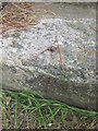
Ordnance Survey Rivet
This OS rivet can be found on a step to the SW of the road. It marks a point 22.200m above mean sea level.
Image: © Adrian Dust
Taken: 14 Jun 2014
0.10 miles
2
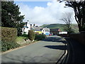
Tywyn War Memorial Cottage Hospital
Built 1920-22 by F. Howarth, architect of Tywyn, as a war memorial funded by public subscription.
Image: © Eirian Evans
Taken: 26 Mar 2019
0.10 miles
3
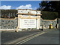
Tywyn War Memorial
At the entrance to the Cottage Hospital which was built in 1920-22, funded by public subscription.
Image: © Eirian Evans
Taken: 26 Mar 2019
0.12 miles
4
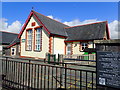
Ysgol Penybryn, Tywyn
Located in the heart of Tywyn, the traditional roadside face hides a large and modern school from the road.
Image: © Eirian Evans
Taken: 26 Mar 2019
0.19 miles
5
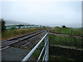
The Cambrian Coast railway line
A public right of way uses a farm occupation crossing here.
Image: © John Lucas
Taken: 10 Jul 2006
0.19 miles
6
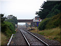
Cambrian Coast Railway
Looking north-westwards towards Tywyn.
Image: © John Lucas
Taken: 10 Jul 2006
0.20 miles