
IMAGES TAKEN NEAR TO
TYWYN, LL36 9BH
Introduction
This page details the photographs taken nearby to LL36 9BH by members of the Geograph project.
The Geograph project started in 2005 with the aim of publishing, organising and preserving representative images for every square kilometre of Great Britain, Ireland and the Isle of Man.

There are currently over 7.5m images from over14,400 individuals and you can help contribute to the project by visiting https://www.geograph.org.uk
Image Map
Images are licensed for reuse under creativecommons.org/licenses/by-sa/2.0
Notes
- Clicking on the map will re-center to the selected point.
- The higher the marker number, the further away the image location is from the centre of the postcode.
Image Listing (13 Images Found)
Images are licensed for reuse under creativecommons.org/licenses/by-sa/2.0
Image
Details
Distance
1
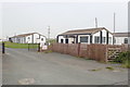
Morfa camp, Tywyn
Tywyn was a major training ground for the amphibious warfare landings in the Second World War and had a strategic war base. The links with the armed forces came to an end when the Joint Service Mountain Training Centre at Morfa Camp closed in 1999. It is now in private ownership and many buildings are let as small storage units.
Image: © Eirian Evans
Taken: 12 Aug 2020
0.09 miles
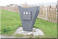
5
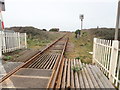
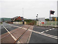
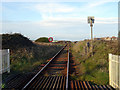
Cambrian Coast railway at Tywyn
Heading north
Image: © Eirian Evans
Taken: 19 Mar 2019
0.20 miles

8

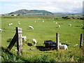
Mid Wales WWII defences: RAF Morfa (Tywyn) - pillbox (1)
-
Pillbox: DoB ID: e11508
An unusual pillbox that may have had an attached LAA post. The wooden post on the right has been hollowed out inside, it may be linked to the pillbox in some way, but its purpose is unknown.
Image
Image: © Mike Searle
Taken: 14 May 2017
0.24 miles
9

Mid Wales WWII defences: RAF Morfa (Tywyn) - pillbox (2)
-
Pillbox: DoB ID: e11508
Three loopholes face inwards towards the airfield, two other loops, one at each end of the pillbox face north and south respectively.
Image
Image: © Mike Searle
Taken: 14 May 2017
0.24 miles
10

Mid Wales WWII defences: RAF Morfa (Tywyn) - pillbox (3)
-
Pillbox: DoB ID: e11508
Behind the main body of the pillbox is an open area having a hexagonal concrete platform enclosed by a roofless partially demolished surrounding wall. I'm hazarding a guess that this area may have been an attached LAA post.
Image
Image: © Mike Searle
Taken: 14 May 2017
0.24 miles