1
Ffordd Gwynedd, Tywyn
A motorbike is propped up by the pavement of this road of bungalows off Warwick Place. Cader Walk leads off to the right.
Image: © Stephen McKay
Taken: 15 Jun 2022
0.04 miles
2
Neptune Road lockup garages, Tywyn
Alongside a spur of Neptune Road on the west side of the main route.
Image: © Jaggery
Taken: 22 Oct 2016
0.06 miles
3
Neptune Road flats, Tywyn
Neptune Road leads to Tywyn Beach on the Cardigan Bay coast of southern Gwynedd.
Image: © Jaggery
Taken: 22 Oct 2016
0.08 miles
4
Car park for allotments and playing field in Tywyn
Image: © Steven Brown
Taken: 30 Oct 2023
0.09 miles
5
Tywyn Wharf railway station
Opened in 1866 as King's station on the narrow gauge Talyllyn Railway line, this was a goods station that served as a place for transhipment of slates from the narrow gauge to the adjacent Cambrian Railway main line. This later opened as a passenger station around 1911 as Towyn Wharf, later renamed to Tywyn Wharf in 1975. The Narrow Gauge Railway Museum is housed in the building, and has been at the station since 1955.
Image: © Fabian Musto
Taken: 3 Jun 2021
0.10 miles
6
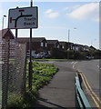
Route to the beach, Tywyn
The sign faces Neptune Road. Traeth is Welsh for Beach.
Image: © Jaggery
Taken: 22 Oct 2016
0.10 miles
7
Junction of Warwick Place and Neptune Road, Tywyn
Neptune Road on the left leads to several caravan parks and the coast.
Image: © Jaggery
Taken: 22 Oct 2016
0.10 miles
8
Mail Box and Bench, Tywyn
A small patch of grass at a street corner with playing fields beyond.
Image: © Des Blenkinsopp
Taken: 5 Aug 2019
0.10 miles
9
Queen Elizabeth II postbox and a dragon tail bench on a Tywyn corner
On the corner of Faenol Isaf and Neptune Road.
Image: © Jaggery
Taken: 22 Oct 2016
0.10 miles
10
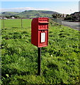
Queen Elizabeth II postbox on a Tywyn corner
Located here. http://www.geograph.org.uk/photo/5264421 The maker's name embossed on the bottom of the box is
CARRON COMPANY STIRLINGSHIRE.
Image: © Jaggery
Taken: 22 Oct 2016
0.10 miles


