
IMAGES TAKEN NEAR TO
ABERDOVEY, LL35 0NR
Introduction
This page details the photographs taken nearby to LL35 0NR by members of the Geograph project.
The Geograph project started in 2005 with the aim of publishing, organising and preserving representative images for every square kilometre of Great Britain, Ireland and the Isle of Man.

There are currently over 7.5m images from over14,400 individuals and you can help contribute to the project by visiting https://www.geograph.org.uk
Image Map
Images are licensed for reuse under creativecommons.org/licenses/by-sa/2.0
Notes
- Clicking on the map will re-center to the selected point.
- The higher the marker number, the further away the image location is from the centre of the postcode.
Image Listing (146 Images Found)
Images are licensed for reuse under creativecommons.org/licenses/by-sa/2.0
Image
Details
Distance
1
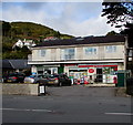
Aberdyfi Stores and Post Office, Aberdovey
On the north side of the A493, the main road through the village.
Image: © Jaggery
Taken: 17 Oct 2016
0.01 miles
2
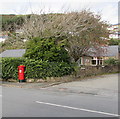
King George VI pillarbox on an Aberdovey corner
The pillarbox is on the north side of the A493, the main road through Aberdovey,
at the edge of the access road to Aberdyfi Stores and Post Office. http://www.geograph.org.uk/photo/5162441
Image: © Jaggery
Taken: 17 Oct 2016
0.02 miles
3
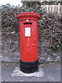
George VI postbox, Aberdovey
Located more or less right outside the town's Post Office, this is pillar box LL35 107D.
Image: © Richard Law
Taken: 7 Mar 2020
0.02 miles
4
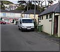
Public toilets near the post office, Aberdovey
The toilets are on the south side of the A493, the main road through the village.
The post office is inside Aberdyfi Stores http://www.geograph.org.uk/photo/5162441 on the north side of the A493.
Image: © Jaggery
Taken: 17 Oct 2016
0.03 miles
5
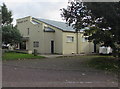
Neuadd Dyfi, Aberdovey
Welsh for Dovey Hall, Neuadd Dyfi is a community hall, conference centre
and theatre on the south side of the A493, the main road through the village.
Image: © Jaggery
Taken: 17 Oct 2016
0.03 miles
6
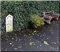
Old milepost and a bench, Aberdovey
At the edge of a bus stop on the south side of the A493, the main road through the village,
the milepost http://www.geograph.org.uk/photo/1383986 shows 4 miles to Towyn and 10 to Machynlleth.
Image: © Jaggery
Taken: 17 Oct 2016
0.03 miles
7
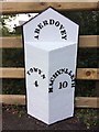
Old Milepost by the A493, Aberdovey
Cast iron post on A493, Community of Aberdovey (Gwynedd UA), opposite school, Aberdyfi, on verge, back to wooden fence, South-southwest side of road. Probably late C19th, erected by the County Council.
Inscription reads:-
: TOWYN / 4 : : ABERDOVEY : : MACHYNLLETH / 10 :
Milestone Society National ID: MER_MCTW10.
Image: © Milestone Society
Taken: 25 Aug 2017
0.03 miles
8
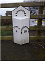
Aberdovey milepost by the A493
A well-maintained toll-road milepost, cast iron, situated more or less opposite the town's Post Office.
Image: © Richard Law
Taken: 7 Mar 2020
0.03 miles
9
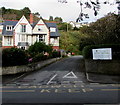
Unnamed side road in Aberdovey
From the north side of the A493, the main road through the village, past the
edge of Aberdovey Primary School (Ysgol Gynradd Aberdyfi in Welsh) on the right.
The yellow road markings are part of the Keep Clear Zone outside the school.
Image: © Jaggery
Taken: 17 Oct 2016
0.03 miles
10
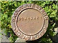
Great Western Railway boundary marker
I found three of these by the path that parallels the railway line. They are fixed on the ends of sections of rail and are about two feet high.
Image: © Mike White
Taken: 27 Jun 2009
0.03 miles