
IMAGES TAKEN NEAR TO
Glanyrafon Road, PENMAENMAWR, LL34 6UF
Introduction
This page details the photographs taken nearby to Glanyrafon Road, LL34 6UF by members of the Geograph project.
The Geograph project started in 2005 with the aim of publishing, organising and preserving representative images for every square kilometre of Great Britain, Ireland and the Isle of Man.

There are currently over 7.5m images from over14,400 individuals and you can help contribute to the project by visiting https://www.geograph.org.uk
Image Map
Images are licensed for reuse under creativecommons.org/licenses/by-sa/2.0
Notes
- Clicking on the map will re-center to the selected point.
- The higher the marker number, the further away the image location is from the centre of the postcode.
Image Listing (7 Images Found)
Images are licensed for reuse under creativecommons.org/licenses/by-sa/2.0
Image
Details
Distance
1
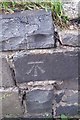
Ordnance Survey Cut Mark
This OS cut mark can be found on the wall NW side of Glan Yr Afon Road. It marks a point 12.604m above mean sea level.
Image: © Adrian Dust
Taken: 26 Oct 2018
0.16 miles
2
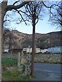
Stench pipe on Glan-y-Mor Road, Dwygyfylchi
Image: © Meirion
Taken: 15 Jan 2020
0.16 miles
3
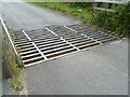
Cattle grid on Glan-yr-afon Road, Dwygyfylchi
Image: © Meirion
Taken: 30 Jul 2024
0.20 miles
4
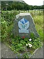
Snowdonia National Park marker, Dwygyfylchi
Image: © Meirion
Taken: 30 Jul 2024
0.21 miles
6
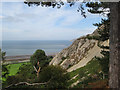
Pine trees and scree
Coed Pendyffryn mantles the lower slope of Alltwen, with pines dominating at the higher levels. Bracken has invaded where soil is thicker, but cannot get a hold on the scree. In the distance, the very tip of Great Orme's Head can be seen.
Image: © Jonathan Wilkins
Taken: 26 Aug 2011
0.24 miles
7
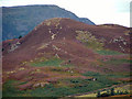
Alltwen
Hillside viewed from Conwy Mountain to the East
Image: © Chris Shaw
Taken: Unknown
0.25 miles