
IMAGES TAKEN NEAR TO
Penmaenmawr Road, LLANFAIRFECHAN, LL33 0NY
Introduction
This page details the photographs taken nearby to Penmaenmawr Road, LL33 0NY by members of the Geograph project.
The Geograph project started in 2005 with the aim of publishing, organising and preserving representative images for every square kilometre of Great Britain, Ireland and the Isle of Man.

There are currently over 7.5m images from over14,400 individuals and you can help contribute to the project by visiting https://www.geograph.org.uk
Image Map
Images are licensed for reuse under creativecommons.org/licenses/by-sa/2.0
Notes
- Clicking on the map will re-center to the selected point.
- The higher the marker number, the further away the image location is from the centre of the postcode.
Image Listing (136 Images Found)
Images are licensed for reuse under creativecommons.org/licenses/by-sa/2.0
Image
Details
Distance
1
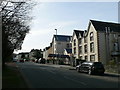
Plas Menai, Llanfairfechan
Health centre, including a surgery and a chemist shop, on Penmaenmawr Road.
Image: © Eirian Evans
Taken: 6 Mar 2012
0.02 miles
2
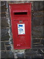
Elizabeth II post box on Penmaenmawr Road Llanfairfechan
LL33 47
Image: © Meirion
Taken: 3 Sep 2019
0.05 miles
3

BT telephone exchange, Llanfairfechan
See also: Image
Image: © Meirion
Taken: 25 Jul 2025
0.08 miles
4

Datestone on BT telephone exchange, Llanfairfechan
(Crown) EIIR 1971
See also: Image
Image: © Meirion
Taken: 25 Jul 2025
0.08 miles
5
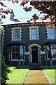
Benarth House, Llanfairfechan
According to the North Wales Chronicle and Advertiser (6 November 1914), 8 Belgian refugees were staying at Benarth House.
There are two tablets either side of the doorway.
On the left hand side (and translated into English) is
''In memory
The soldiers and sailors from the CM churches in
Liverpool and district
that were lost in
the Great War 1914 - 18''
CM ='Calvinistic Methodist' - now known as the Presbyterian Church Of Wales. Many Welsh men and women went to Liverpool to work.
The right hand tablet (again translated into English)
''The Benarth
Branch of the Bontnewydd Home
Opened
July 26, 1924''
Image: © Richard Hoare
Taken: 20 Jul 2017
0.09 miles
6
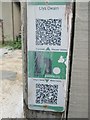
HiPoints information QR code at Llys Owain, Llanfairfechan
HistoryPoints.org brings local history to your mobile phone. Main website at http://historypoints.org
Image: © Meirion
Taken: 6 Sep 2019
0.11 miles
8
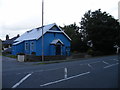
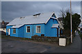
Methodist Chapel, Aber Road
This corrugated iron building on Aber Road is the English Methodist Chapel.
Image: © Christopher Hall
Taken: 9 Aug 2014
0.11 miles
9
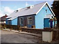
Wesleyan Methodist Chapel, Llanfairfechan
Built in the late 19th century. Also known locally as 'Capel Sinc'.
Image: © Chris Andrews
Taken: 29 Aug 2016
0.11 miles
10

The Provincial Grand Lodge of North Wales
Masonic Hall on Station Road in Llanfairfechan.
Image: © Eirian Evans
Taken: 2 Jun 2009
0.13 miles