
IMAGES TAKEN NEAR TO
Valley Road, LLANFAIRFECHAN, LL33 0ES
Introduction
This page details the photographs taken nearby to Valley Road, LL33 0ES by members of the Geograph project.
The Geograph project started in 2005 with the aim of publishing, organising and preserving representative images for every square kilometre of Great Britain, Ireland and the Isle of Man.

There are currently over 7.5m images from over14,400 individuals and you can help contribute to the project by visiting https://www.geograph.org.uk
Image Map
Images are licensed for reuse under creativecommons.org/licenses/by-sa/2.0
Notes
- Clicking on the map will re-center to the selected point.
- The higher the marker number, the further away the image location is from the centre of the postcode.
Image Listing (11 Images Found)
Images are licensed for reuse under creativecommons.org/licenses/by-sa/2.0
Image
Details
Distance
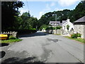
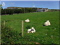
3
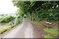
The North Wales Path follows this road for a while
They've kindly provided a seat which I tested, of course.
Image: © Ian Greig
Taken: 10 Jul 2010
0.12 miles
5
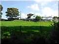
Tŷ'n-y-llwyfan Farm
Tŷ'n-y-llwyfan translates as 'house on the platform', maybe because it looks down on Llanfairfechan.
Image: © David Medcalf
Taken: 17 Aug 2019
0.15 miles
6
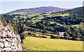
Fields below Mount Road
Mount Road climbs out of Llanfairfechan to access various properties on the slope on the north side of the Afon Llanfairfechan, including the large house at Plas Heulog, which at the time the image was recorded - August 1977 - was a country hotel operated by the Countrywide Holiday Association.
The distant hill is Drosgl; it has little identity of its own but the ridge rises ultimately to a number of significant mountain tops of the Carneddau group.
(Note: The Countrywide Holiday Association ceased to operate in the early 2000s. A number of their houses / hotels was taken on by HF Holidays; an organisation with a similar outlook.)
Image: © Trevor Littlewood
Taken: 31 Aug 1977
0.17 miles
9
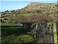
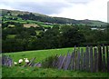
Nant-y-pandy view
This excellent slate fence leads the eye across the valley, where it is known as Nant-y-pandy. The houses on Valley Road are almost invisible through the trees. In the distance, the summit of Penmaen Mawr is a rocky focus.
Image: © Jonathan Wilkins
Taken: 7 Mar 2014
0.21 miles
10
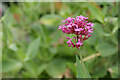
Red Valerian (Cetranthus ruber)
A helpful Geograph member identified this flower for me and provided this link:
http://www.floralimages.co.uk/pcentrruber.htm
Image: © Ian Greig
Taken: 10 Jul 2010
0.23 miles