
IMAGES TAKEN NEAR TO
Tal-y-Bont, CONWY, LL32 8SG
Introduction
This page details the photographs taken nearby to LL32 8SG by members of the Geograph project.
The Geograph project started in 2005 with the aim of publishing, organising and preserving representative images for every square kilometre of Great Britain, Ireland and the Isle of Man.

There are currently over 7.5m images from over14,400 individuals and you can help contribute to the project by visiting https://www.geograph.org.uk
Image Map
Images are licensed for reuse under creativecommons.org/licenses/by-sa/2.0
Notes
- Clicking on the map will re-center to the selected point.
- The higher the marker number, the further away the image location is from the centre of the postcode.
Image Listing (10 Images Found)
Images are licensed for reuse under creativecommons.org/licenses/by-sa/2.0
Image
Details
Distance
1
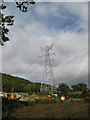
Transmission line maintenance
Renewal of the conductors on the transmission line leading to Dolgarrog switching station. This is an interesting pylon because the two lines diverge.
Image: © Jonathan Wilkins
Taken: 8 Sep 2013
0.10 miles
3
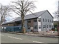
New school building
Rebuilding the school at Dolgarrog is the culmination of a scheme to close and amalgamate adjoining village schools on one site.
Image: © Jonathan Wilkins
Taken: 17 Mar 2019
0.16 miles
4
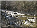
Afon Porth-llwyd 1
Water running down the Afon Porth-llwyd in good weather is always a surprise, since it is almost completely dammed at Coedty Reservoir and normally only reaches the foot of the escarpment after going through the turbines of the power station, or when flooding is imminent, by controlled release. At the time of the image, work was proceeding on the low-head pipeline (Image), so none was taken to the turbines.
Image: © Jonathan Wilkins
Taken: 21 Apr 2013
0.19 miles
5
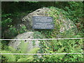
Dolgarrog Dam Disaster Boulders
The boulders and slate plaque depicting the Dolgarrog Dam disaster of November 1925 when part of the Eigiau dam wall above the village collapsed. The plaque outlines the story.
Image: © Richard Hoare
Taken: 14 Aug 2009
0.21 miles
6
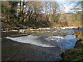
Afon Porth-llwyd 2
An idyllic, but unusual scene below the road bridge at Dolgarrog. See Image for a full explanation.
Image: © Jonathan Wilkins
Taken: 21 Apr 2013
0.21 miles
7
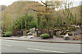
Dolgarrog dam disaster memorial (2)
The night of 2 November 1925 was dark and stormy in North Wales. The dam at Llyn Eigiau, up in the mountains west of Dolgarrog, fractured under stress and released a large volume of water down the valley to Coedty reservoir. At 9pm Coedty dam burst with an almighty roar, cascading millions of gallons of water and thousands of tons of Ice Age boulders down a narrow gorge onto the unsuspecting villagers of Dolgarrog.
By the following day the death toll was 10 adults and six children. The nearby Aluminium Corporation factory (now the site of Surf Snowdonia ) was seriously flooded but the 200 or so workers there were all successfully rescued. The death toll might have been higher had not most of the villagers been attending a cinema show in the community hall on higher ground.
Many of the boulders some weighing up to 500 tons lie in situ and some can be seen in this image.
In 2017 Dolgarrog Community Council received a grant of £10,000 from the Lottery Fund Sharing Heritage programme.
Money has been spent on new information boards interpreting the history and there will be a permanent museum / exhibition in a room at the Dolgarrog Community Centre.
Image: © Richard Hoare
Taken: 8 Nov 2017
0.24 miles
8

Dolgarrog dam disaster memorial
The night of 2 November 1925 was dark and stormy in North Wales. The dam at Llyn Eigiau, up in the mountains west of Dolgarrog, fractured under stress and released a large volume of water down the valley to Coedty reservoir. At 9pm Coedty dam burst with an almighty roar, cascading millions of gallons of water and thousands of tons of Ice Age boulders down a narrow gorge onto the unsuspecting villagers of Dolgarrog.
By the following day the death toll was 10 adults and six children. The nearby Aluminium Corporation factory (now the site of Surf Snowdonia ) was seriously flooded but the 200 or so workers there were all successfully rescued. The death toll might have been higher had not most of the villagers been attending a cinema show in the community hall on higher ground.
Many of the boulders some weighing up to 500 tons lie in situ.
In 2017 Dolgarrog Community Council received a grant of £10,000 from the Lottery Fund Sharing Heritage programme.
Money has been spent on new information boards interpreting the history and there will be a permanent museum/ exhibition in a room at the Dolgarrog Community Centre.
Image: © Richard Hoare
Taken: 8 Nov 2017
0.24 miles
9
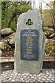
Dolgarrog dam disaster memorial citation
The night of 2 November 1925 was dark and stormy in North Wales. The dam at Llyn Eigiau, up in the mountains west of Dolgarrog, fractured under stress and released a large volume of water down the valley to Coedty reservoir. At 9pm Coedty dam burst with an almighty roar, cascading millions of gallons of water and thousands of tons of Ice Age boulders down a narrow gorge onto the unsuspecting villagers of Dolgarrog.
By the following day the death toll was 10 adults and six children. The nearby Aluminium Corporation factory (now the site of Surf Snowdonia ) was seriously flooded but the 200 or so workers there were all successfully rescued. The death toll might have been higher had not most of the villagers been attending a cinema show in the community hall on higher ground.
Many of the boulders some weighing up to 500 tons lie in situ.
In 2017 Dolgarrog Community Council received a grant of £10,000 from the Lottery Fund Sharing Heritage programme.
Money has been spent on new information boards interpreting the history and there will be a permanent museum / exhibition in a room at the Dolgarrog Community Centre.
Image: © Richard Hoare
Taken: 8 Nov 2017
0.24 miles
10
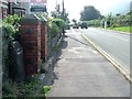
Old Milestone
Old milestone on the B5106 near Dolgarrog, Conway. For overall view see http://www.geograph.org.uk/photo/5121388
Image: © Keith Evans
Taken: 15 Sep 2016
0.25 miles