IMAGES TAKEN NEAR TO
Llanrwst Road, CONWY, LL32 8RQ
Introduction
This page details the photographs taken nearby to Llanrwst Road, LL32 8RQ by members of the Geograph project.
The Geograph project started in 2005 with the aim of publishing, organising and preserving representative images for every square kilometre of Great Britain, Ireland and the Isle of Man.

There are currently over 7.5m images from over14,400 individuals and you can help contribute to the project by visiting https://www.geograph.org.uk
Image Map
Images are licensed for reuse under creativecommons.org/licenses/by-sa/2.0
Notes
- Clicking on the map will re-center to the selected point.
- The higher the marker number, the further away the image location is from the centre of the postcode.
Image Listing (9 Images Found)
Images are licensed for reuse under creativecommons.org/licenses/by-sa/2.0
Image
Details
Distance
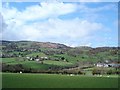
2
Gorse Hill and Iolyn Park
Looking back from summit of Gorse Hill to caravan park in drizzle and fading light.
Image: © Rude Health
Taken: 24 Nov 2012
0.14 miles
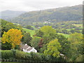
3
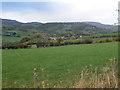
Conwy valley countryside
Looking west towards Tal y Fan.
Image: © Eirian Evans
Taken: 20 Nov 2007
0.19 miles
4
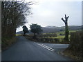
Henryd Road with lane to Hendre Road on right.
Image: © Colin Pyle
Taken: 18 Jan 2010
0.20 miles
6
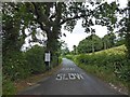
Araf and a sign saying road narrows but this looks wide for the roads around here
Image: © Steve Fareham
Taken: 10 Aug 2015
0.21 miles
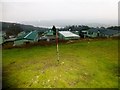
7
Iolyn Park - Middle Hill
Middle Hill on Iolyn Park which maybe a P36 or P18. A survey will be required to say which of the 3 tops of Iolyn Park is the highest. I think that Middle Hill will be the lowest of the three.
Image: © Rude Health
Taken: 24 Nov 2012
0.22 miles
8
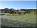
Frosted valley
Low sun is beginning to melt the hoar-frost in fields between Henryd and Groesffordd, while snow lies on higher ground.
Image: © Jonathan Wilkins
Taken: 15 Dec 2022
0.23 miles
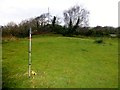
9
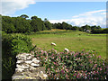
Meadows by the Afon Gyffin
Meadows lying between the road to Henryd and the Afon Gyffin.
Image: © Jonathan Wilkins
Taken: 12 Jul 2009
0.24 miles