
IMAGES TAKEN NEAR TO
Ty Gwyn Gardens, CONWY, LL32 8RA
Introduction
This page details the photographs taken nearby to Ty Gwyn Gardens, LL32 8RA by members of the Geograph project.
The Geograph project started in 2005 with the aim of publishing, organising and preserving representative images for every square kilometre of Great Britain, Ireland and the Isle of Man.

There are currently over 7.5m images from over14,400 individuals and you can help contribute to the project by visiting https://www.geograph.org.uk
Image Map
Images are licensed for reuse under creativecommons.org/licenses/by-sa/2.0
Notes
- Clicking on the map will re-center to the selected point.
- The higher the marker number, the further away the image location is from the centre of the postcode.
Image Listing (459 Images Found)
Images are licensed for reuse under creativecommons.org/licenses/by-sa/2.0
Image
Details
Distance
1
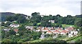
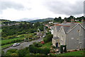
The Mount Pleasant area of town seen from the town walls.
This area is a leafy suburb of Conwy.
Image: © N Chadwick
Taken: 30 Aug 2009
0.02 miles
2
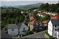
View from Conwy's town wall
View to the south-west and the mountains of Snowdonia from the town wall in Conwy.
Image: © Philip Halling
Taken: 26 May 2008
0.05 miles
4
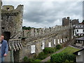
Part of Conwy town walls
Access is free. The walkway gives an unparalleled perspective on the town, some great roofscapes and a proper overview of what Conwy town can offer. The walkway is not complete - there are a few parts that don't have access, such as above the rail line.
Image: © Jeremy Bolwell
Taken: 14 Jul 2010
0.07 miles
5
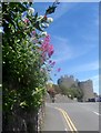
Triaglog coch / Red Valerian / Centranthus ruber
Image: © Ceri Thomas
Taken: 17 May 2014
0.07 miles
7
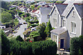
St Agnes Road, Conwy
Looking down from Porth Uchaf (Upper Gate) to suburban housing stretching away to the south-west of the town. Bryn Guest House is on the right.
Image: © Stephen McKay
Taken: 29 Aug 2024
0.08 miles
8
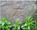
Ordnance Survey Cut Mark
This OS cut mark can be found on the wall south side of Sychnant Pass Road. It marks a point 48.654m above mean sea level.
Image: © Adrian Dust
Taken: 12 Sep 2019
0.09 miles
9
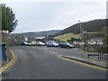
Sychnant Pass Road/St Agnes Road junction.
Image: © Colin Pyle
Taken: 18 Jan 2010
0.09 miles
10
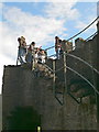
Tower in Conwy town walls
The towers were open-backed and had an independent stair to ground level, so that each section could be isolated if it was attacked and scaled.
Image: © Eirian Evans
Taken: 19 Jul 2008
0.10 miles