IMAGES TAKEN NEAR TO
Deganwy Beach, CONWY, LL31 9YR
Introduction
This page details the photographs taken nearby to Deganwy Beach, LL31 9YR by members of the Geograph project.
The Geograph project started in 2005 with the aim of publishing, organising and preserving representative images for every square kilometre of Great Britain, Ireland and the Isle of Man.

There are currently over 7.5m images from over14,400 individuals and you can help contribute to the project by visiting https://www.geograph.org.uk
Image Map
Images are licensed for reuse under creativecommons.org/licenses/by-sa/2.0
Notes
- Clicking on the map will re-center to the selected point.
- The higher the marker number, the further away the image location is from the centre of the postcode.
Image Listing (146 Images Found)
Images are licensed for reuse under creativecommons.org/licenses/by-sa/2.0
Image
Details
Distance
1
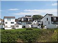
Deganwy Beach Estate 3
The Deganwy Beach Estate was developed on the site of the former West Shore Bathing Pool, or colloquially Deganwy Lido, which was open between 1934 and the early 1960s. The striking, angular architecture led to it being known locally as 'Legoland', but it appears to be modelled upon contemporary developments in mediterranean resorts.
This part of the estate occupies the former bathing pool area which was to the north of the access road and beach-path footbridge. Note the prominent peak and Deganwy Castle in the background.
Image: © Jonathan Wilkins
Taken: 25 Jun 2020
0.01 miles
2
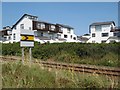
Deganwy Beach Estate 4
The Deganwy Beach Estate was developed on the site of the former West Shore Bathing Pool, or colloquially Deganwy Lido, which was open between 1934 and the early 1960s. The striking, angular architecture led to it being known locally as 'Legoland', but it appears to be modelled upon contemporary developments in mediterranean resorts.
Most publicity for the properties emphasises the extensive sea views but does not mention proximity to the railway line, though efforts are clearly made to frustrate trainspotters. The railway signal is interesting, comprising a 'fixed-distant' aspect, which is an unconditional warning of the approaching terminus and its home signal post.
Image: © Jonathan Wilkins
Taken: 25 Jun 2020
0.02 miles
3

Deganwy Beach Estate 1
The Deganwy Beach Estate was developed on the site of the former West Shore Bathing Pool, or colloquially Deganwy Lido, which was open between 1934 and the early 1960s. The striking, angular architecture led to it being known locally as 'Legoland', but it appears to be modelled upon contemporary developments in mediterranean resorts.
Image: © Jonathan Wilkins
Taken: 25 Jun 2020
0.02 miles
4
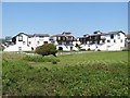
Deganwy Beach Estate 2
The Deganwy Beach Estate was developed on the site of the former West Shore Bathing Pool, or colloquially Deganwy Lido, which was open between 1934 and the early 1960s. The striking, angular architecture led to it being known locally as 'Legoland', but it appears to be modelled upon contemporary developments in mediterranean resorts.
This view shows the southern boundary of the estate and also the lawns of the first plot of the former site to be developed.
Image: © Jonathan Wilkins
Taken: 25 Jun 2020
0.02 miles
5
The Traeth Melyn Estate
Traeth Melyn means "golden beach". The estate has been built on low lying land between the A546 and the railway line.
Image: © Eric Jones
Taken: 20 Oct 2007
0.02 miles
6

Railway at Deganwy
Virgin Trains express passing Deganwy.
Image: © Wayland Smith
Taken: 16 Feb 2008
0.03 miles
7
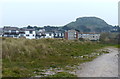
Houses at Deganwy
On the right is the 110 m (361 ft) volcanic plug, upon which stood Deganwy Castle (Castell Degannwy).
Image: © Mat Fascione
Taken: 16 Apr 2019
0.04 miles
8

Ordnance Survey Rivet
This OS rivet can be found on the wall at the junction of Hawes Drive & Deganwy Road. It marks a point 13.799m above mean sea level.
Image: © Adrian Dust
Taken: 27 Mar 2023
0.05 miles