IMAGES TAKEN NEAR TO
Stamford Street, CONWY, LL31 9UE
Introduction
This page details the photographs taken nearby to Stamford Street, LL31 9UE by members of the Geograph project.
The Geograph project started in 2005 with the aim of publishing, organising and preserving representative images for every square kilometre of Great Britain, Ireland and the Isle of Man.

There are currently over 7.5m images from over14,400 individuals and you can help contribute to the project by visiting https://www.geograph.org.uk
Image Map
Images are licensed for reuse under creativecommons.org/licenses/by-sa/2.0
Notes
- Clicking on the map will re-center to the selected point.
- The higher the marker number, the further away the image location is from the centre of the postcode.
Image Listing (121 Images Found)
Images are licensed for reuse under creativecommons.org/licenses/by-sa/2.0
Image
Details
Distance
1
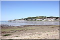
View towards Deganwy from the Wales Coast Path
The view north from the Wales Coast Path towards Deganwy. The photographer position is above the A55 as it travels through the Conwy Tunnel under the Conwy Estuary.
Image: © Jeff Buck
Taken: 19 Jul 2016
0.04 miles
2
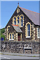
Peniel Presbyterian Church, Deganwy
This handsome chapel, part of the Presbyterian Church of Wales, dates from 1884 and its services are held in Welsh.
Image: © Stephen McKay
Taken: 20 Jun 2024
0.07 miles
3
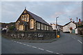
Peniel Church
A Welsh-speaking Welsh Presbyterian church.
Image: © Bill Boaden
Taken: 17 Feb 2017
0.07 miles
4

Peniel Presbyterian Church, Deganwy
The board outside this chapel, which dates from 1884, is in Welsh only and services here are held in the language. Croeso cynnes i bawb translates into English as 'a warm welcome to everyone'. See Image for a wider view.
Image: © Stephen McKay
Taken: 20 Jun 2024
0.07 miles
5
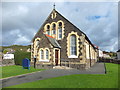
Peniel, Deganwy
A small Welsh-speaking church in Deganwy, Conwy and home to the History of Deganwy Group. http://www.deganwyhistory.co.uk/
Image: © Richard Hoare
Taken: 23 Oct 2013
0.08 miles
6
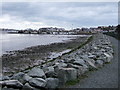
The North Wales Path
Near to the Access point at the bottom of Pentywyn Road, for the North Wales Path. The New development at Deganwy Marina is in the Background. http://www.geograph.org.uk/photo/677318
Image: © BrianPritchard
Taken: 3 Feb 2008
0.08 miles