
IMAGES TAKEN NEAR TO
Overlea Avenue, CONWY, LL31 9TD
Introduction
This page details the photographs taken nearby to Overlea Avenue, LL31 9TD by members of the Geograph project.
The Geograph project started in 2005 with the aim of publishing, organising and preserving representative images for every square kilometre of Great Britain, Ireland and the Isle of Man.

There are currently over 7.5m images from over14,400 individuals and you can help contribute to the project by visiting https://www.geograph.org.uk
Image Map
Images are licensed for reuse under creativecommons.org/licenses/by-sa/2.0
Notes
- Clicking on the map will re-center to the selected point.
- The higher the marker number, the further away the image location is from the centre of the postcode.
Image Listing (58 Images Found)
Images are licensed for reuse under creativecommons.org/licenses/by-sa/2.0
Image
Details
Distance
1
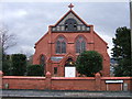
Bethel Methodist Church, Deganwy
This Chapel was built in 1905, at the corner of Pentywyn Road and Overlea Avenue. The room at the back of the Chapel was used as a classroom for Deganwy Primary School, on Park Drive, in the 1950's
Image: © BrianPritchard
Taken: 3 Feb 2008
0.06 miles
2
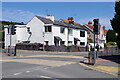
Pentywyn Road, Deganwy
Deep in the Llandudno suburbs, Pentywyn Road meets Overlea Avenue and Park Drive at this junction. Pentywyn Road is part of the B5115.
Image: © Stephen McKay
Taken: 20 Jun 2024
0.07 miles
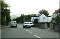
4
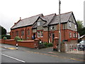
Bethel Chapel
The Bethel Chapel Schoolroom was the venue for a Macmillan Coffee Morning
Image: © BrianPritchard
Taken: 28 Sep 2019
0.09 miles
5
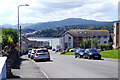
Pentywyn Road, Deganwy
Looking down the B5115 to the Conwy estuary.
Image: © Stephen McKay
Taken: 20 Jun 2024
0.10 miles
7
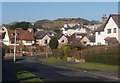
Warren Drive, Deganwy
The Vardre, which has the remains of Deganwy Castle, is in the background.
Image: © Ceri Thomas
Taken: 6 Feb 2010
0.12 miles
8
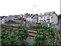
Access from the bottom of Pentywyn Hill to The North Wales Path
You can cross the railway at this point, to join the North Wales Path. In the background is the road junction of Glan-y-Mor Road, Pentywyn Road and Warren Road. The Harbour View used to be called Buckley's Fish and Chip Shop, and the Newsagents shop a little way up the hill, used to be called Hydes.
Image: © BrianPritchard
Taken: 3 Feb 2008
0.14 miles
10
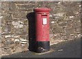
Blwch post o gyfnod Edward VII / An Edward VIIth postbox
Image: © Ceri Thomas
Taken: 6 Feb 2010
0.16 miles