
IMAGES TAKEN NEAR TO
Bryn Y Bia Place, LLANDUDNO, LL30 3AT
Introduction
This page details the photographs taken nearby to Bryn Y Bia Place, LL30 3AT by members of the Geograph project.
The Geograph project started in 2005 with the aim of publishing, organising and preserving representative images for every square kilometre of Great Britain, Ireland and the Isle of Man.

There are currently over 7.5m images from over14,400 individuals and you can help contribute to the project by visiting https://www.geograph.org.uk
Image Map
Images are licensed for reuse under creativecommons.org/licenses/by-sa/2.0
Notes
- Clicking on the map will re-center to the selected point.
- The higher the marker number, the further away the image location is from the centre of the postcode.
Image Listing (81 Images Found)
Images are licensed for reuse under creativecommons.org/licenses/by-sa/2.0
Image
Details
Distance
1
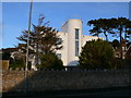
House on Bryn y Bia Road
Art deco house
Image: © Eirian Evans
Taken: 28 Jan 2012
0.04 miles
2
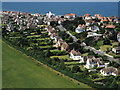
Penrhynside Mountain - the view north
View north of Craigside (a Llandudno suburb) abutting Bodafon farm, the green last barrier between the merger of Llandudno and Colwyn Bay.
Image: © GP Williams
Taken: 7 Sep 2005
0.05 miles
3
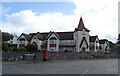
Bryn-y-Bia Lodge, Craigside
Showing position of Postbox No. LL30 10.
See Image] for postbox.
Image: © JThomas
Taken: 15 Apr 2024
0.07 miles
4
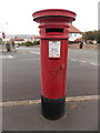
Craigside: postbox № LL30 10, Bryn-y-Bia Road
A Victorian postbox just around the corner from the main Colwyn Road, emptied finally at 5pm on weekdays and at noon on Saturdays.
Image: © Chris Downer
Taken: 15 Aug 2013
0.07 miles
5
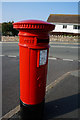
Victorian postbox on Bryn Y Bia Road, Llandudno
Image: © Ian S
Taken: 16 Sep 2014
0.08 miles
6
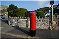
Victorian postbox on Bryn Y Bia Road, Llandudno
Image: © Ian S
Taken: 16 Sep 2014
0.08 miles
7
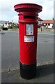
Victorian postbox on Colwyn Road, Craigside
Postbox No. LL30 10.
See Image] for context.
Image: © JThomas
Taken: 15 Apr 2024
0.08 miles

10
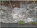
Ordnance Survey Cut Mark
This OS cut mark can be found on the wall north side of Colwyn Road. It marks a point 26.950m above mean sea level.
Image: © Adrian Dust
Taken: 12 Sep 2023
0.09 miles