IMAGES TAKEN NEAR TO
Tyn Y Coed Road, LLANDUDNO, LL30 2QD
Introduction
This page details the photographs taken nearby to Tyn Y Coed Road, LL30 2QD by members of the Geograph project.
The Geograph project started in 2005 with the aim of publishing, organising and preserving representative images for every square kilometre of Great Britain, Ireland and the Isle of Man.

There are currently over 7.5m images from over14,400 individuals and you can help contribute to the project by visiting https://www.geograph.org.uk
Image Map
Images are licensed for reuse under creativecommons.org/licenses/by-sa/2.0
Notes
- Clicking on the map will re-center to the selected point.
- The higher the marker number, the further away the image location is from the centre of the postcode.
Image Listing (99 Images Found)
Images are licensed for reuse under creativecommons.org/licenses/by-sa/2.0
Image
Details
Distance
1
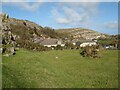
Towards Tyn-y-coed Road
Amenity space occupies what appears to be the remains of a small quarry at the end of the settlement of Cwlach. The billowing folds in the limestone strata are very apparent in the distant hillsides.
Image: © Jonathan Wilkins
Taken: 25 Feb 2021
0.03 miles
3
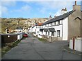
Anglesea Road
A very neat terrace of houses nestling on a ledge approximately half way up the Great Orme. Despite the protestations of modern road maps, the spelling of Anglesea on the old cast-iron street sign is absolutely specific.
Image: © Jonathan Wilkins
Taken: 25 Feb 2021
0.07 miles
4
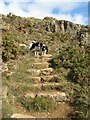
Steps on the zigzag
A steep, zigzag path makes its way up from the Invalid Walk to Cwlach and Tyn-y-coed Road mostly in the form of rough steps that ascend the rocky face of the lower Great Orme.
Image: © Jonathan Wilkins
Taken: 25 Feb 2021
0.08 miles
5
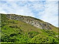
Rock outcrop on the south side of Great Orme
Image: © Stephen Craven
Taken: 20 Jun 2024
0.10 miles
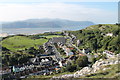
7
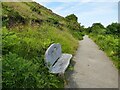
Lovers' Walk, Llandudno
A path across open hillside south-west from Haulfre Gardens.
Image: © Stephen Craven
Taken: 20 Jun 2024
0.12 miles
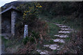
9
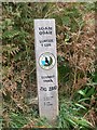
Llwybr IGAM OGAM i'r copa, Llandudno
ZIG ZAG path to the summit.
Image: © Meirion
Taken: 4 Oct 2011
0.13 miles