
IMAGES TAKEN NEAR TO
Abergele Road, COLWYN BAY, LL29 9YF
Introduction
This page details the photographs taken nearby to Abergele Road, LL29 9YF by members of the Geograph project.
The Geograph project started in 2005 with the aim of publishing, organising and preserving representative images for every square kilometre of Great Britain, Ireland and the Isle of Man.

There are currently over 7.5m images from over14,400 individuals and you can help contribute to the project by visiting https://www.geograph.org.uk
Image Map
Images are licensed for reuse under creativecommons.org/licenses/by-sa/2.0
Notes
- Clicking on the map will re-center to the selected point.
- The higher the marker number, the further away the image location is from the centre of the postcode.
Image Listing (63 Images Found)
Images are licensed for reuse under creativecommons.org/licenses/by-sa/2.0
Image
Details
Distance
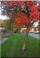
2
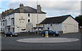
Marine Hotel, Old Colwyn
At 236 Abergele Road on the corner of Llanelian Road.
Image: © Jaggery
Taken: 23 Feb 2016
0.03 miles
3
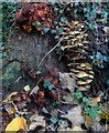
Casgliad o ffyngau / An assemblage of fungi
Image: © Ceri Thomas
Taken: 24 Oct 2013
0.04 miles
4
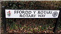
Ffordd y Rotari/Rotary Way name sign, Colwyn Bay
The Welsh/English sign is near the corner of Abergele Road at the southern end of this road. https://www.geograph.org.uk/photo/5749595
Image: © Jaggery
Taken: 23 Feb 2016
0.05 miles
5
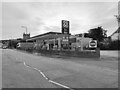
Study of a Gasoline Station
Co-op, Old Colwyn.
This photograph is part of a series taken in homage to the American artist Ed Ruscha's 1963 publication of 'Twentysix Gasoline Stations'.
More properly known as filling stations in the UK, I am attempting to photograph as many as possible to mark the sixty year anniversary.
Image: © David Bremner
Taken: 8 Oct 2023
0.06 miles
6
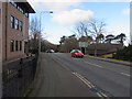
Rotary Way, Colwyn Bay
This way for Colwyn Bay Promenade.
Image: © Jaggery
Taken: 23 Feb 2016
0.07 miles
8
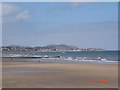
Bae Colwyn Beach
Bae Colwyn (Colwyn Bay) beach from the promenade looking towards Rhos on Sea
Image: © Dot Potter
Taken: 16 Jul 2005
0.09 miles
9
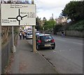
Directions sign facing the A547 Abergele Road, Old Colwyn
Turn left at the roundabout for Conwy and Chester, ahead on the A547 for the centre of Old Colwyn, right for Betws-yn-Rhos.
Image: © Jaggery
Taken: 23 Feb 2016
0.11 miles
10
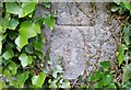
Ordnance Survey 1GL Bolt
This OS bolt can be found on the NW angle of St Catherine's Church. It marks a point 24.508m above mean sea level.
Image: © Adrian Dust
Taken: 17 Jun 2021
0.12 miles