
IMAGES TAKEN NEAR TO
Endsleigh Road, COLWYN BAY, LL29 9DT
Introduction
This page details the photographs taken nearby to Endsleigh Road, LL29 9DT by members of the Geograph project.
The Geograph project started in 2005 with the aim of publishing, organising and preserving representative images for every square kilometre of Great Britain, Ireland and the Isle of Man.

There are currently over 7.5m images from over14,400 individuals and you can help contribute to the project by visiting https://www.geograph.org.uk
Image Map
Images are licensed for reuse under creativecommons.org/licenses/by-sa/2.0
Notes
- Clicking on the map will re-center to the selected point.
- The higher the marker number, the further away the image location is from the centre of the postcode.
Image Listing (96 Images Found)
Images are licensed for reuse under creativecommons.org/licenses/by-sa/2.0
Image
Details
Distance
1
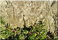
Ordnance Survey Cut Mark
This OS cut mark can be found on the wall SE side of Station Road. It marks a point 18.564m above mean sea level.
Image: © Adrian Dust
Taken: 17 Jun 2021
0.09 miles
2
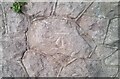
Ordnance Survey Cut Mark
This OS cut mark can be found on the wall east side of Queens Road. It marks a point 18.380m above mean sea level.
Image: © Adrian Dust
Taken: 18 Jun 2021
0.11 miles
3
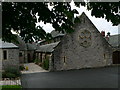
Old Colwyn Methodist Church
Built in turn of the 20th century arts and crafts style.
Image: © Eirian Evans
Taken: 15 Aug 2007
0.12 miles
5
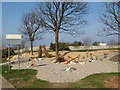
Nautical garden
A very amusing beachscape has been created on the edge of this green space, complete with a tide-line of blue mussel shells and some amorous seahorses on the edge of the 'dunes'. Top marks!
Image: © Jonathan Wilkins
Taken: 18 Mar 2009
0.13 miles
6
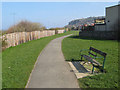
Footpath with bench
The construction of the A55 Expressway along this stretch required the demolition of a number of houses and one side of a short street to the east of this point, so it is appropriate that land here has been given back to the people, although it is not peaceful and the view is not special.
Image: © Jonathan Wilkins
Taken: 18 Mar 2009
0.13 miles
7
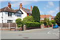
Wynn Avenue, Old Colwyn
Seen at the junction with Station Road. There is no station here now; it was closed in 1952
Image: © Stephen McKay
Taken: 4 Aug 2017
0.13 miles
8
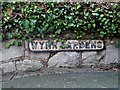
Arwydd stryd anamlwg / An inconspicuous street sign
Image: © Ceri Thomas
Taken: 29 Dec 2012
0.13 miles
9
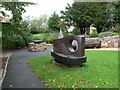
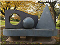
Sculpture in Wynn Gardens, Old Colwyn
This section of Wynn Gardens, the Sensory Garden, includes a group of sculptures by Joss Smith. The centre-piece is a tactile sculpture made of different coloured slate blocks from North West Wales’ slate quarries, and in its shape and form, reflecting the surrounding landscape and seascape. The sensory garden was opened in 2004.
Image: © Eirian Evans
Taken: 15 Aug 2007
0.13 miles
10
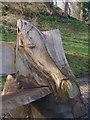
Naddiad pysgodyn / Carving of a fish
This carving forms part of a bench, and is similar to other carvings in Tan-y-Coed Gardens illustrated in Image and Image
Image: © Ceri Thomas
Taken: 7 Apr 2010
0.13 miles