
IMAGES TAKEN NEAR TO
Queens Road, COLWYN BAY, LL29 9DG
Introduction
This page details the photographs taken nearby to Queens Road, LL29 9DG by members of the Geograph project.
The Geograph project started in 2005 with the aim of publishing, organising and preserving representative images for every square kilometre of Great Britain, Ireland and the Isle of Man.

There are currently over 7.5m images from over14,400 individuals and you can help contribute to the project by visiting https://www.geograph.org.uk
Image Map
Images are licensed for reuse under creativecommons.org/licenses/by-sa/2.0
Notes
- Clicking on the map will re-center to the selected point.
- The higher the marker number, the further away the image location is from the centre of the postcode.
Image Listing (35 Images Found)
Images are licensed for reuse under creativecommons.org/licenses/by-sa/2.0
Image
Details
Distance
1
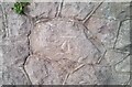
Ordnance Survey Cut Mark
This OS cut mark can be found on the wall east side of Queens Road. It marks a point 18.380m above mean sea level.
Image: © Adrian Dust
Taken: 18 Jun 2021
0.05 miles
2
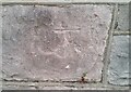
Ordnance Survey Cut Mark
This OS cut mark can be found on the wall NW side of Abergele Road. It marks a point 48.666m above mean sea level.
Image: © Adrian Dust
Taken: 18 Jun 2021
0.08 miles
3
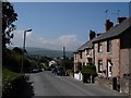
Penmaen Rhos
Road leading down through Penmaen Rhos to Colwyn Bay
Image: © Dot Potter
Taken: 21 Apr 2006
0.13 miles
4
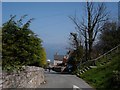
Miners lane to the sea
Miners Lane in Colwyn Bay which leads steeply down towards the sea
Image: © Dot Potter
Taken: 21 Apr 2006
0.13 miles
5
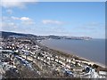
Colwyn Bay
The town, beach, A55 and the railway seen from Colwyn Heights
Image: © Dot Potter
Taken: 4 Mar 2006
0.13 miles
6
Colwyn Bay view
Taken from the old hotel on Colwyn Heights, looking over the town after a night of snow
Image: © Dot Potter
Taken: 4 Mar 2006
0.13 miles
7
High Tide at Old Colwyn
Spring tides and high winds nearly invariably mean problems of road closures along the length of promenade from Old Colwyn to Colwyn Bay.
Photo taken from Hotel 70 / Colwyn Bay Hotel viewpoint.
Image: © IB
Taken: Unknown
0.13 miles
8
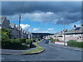
Tan Lan
Mae llechi to gwyrddlas yn rhoi gwedd anghyffredin i'r tai.
The green / blue slates give the houses an unusual appearance.
Image: © Ceri Thomas
Taken: 5 Jul 2008
0.13 miles
9
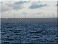
Twrbeini gwynt dan gysgod cymylau / Wind turbines under cloud shadows
These turbines are actually uniform in colour, but cloud shadows can make them appear quite different!
Image: © Ceri Thomas
Taken: 5 Dec 2010
0.13 miles
10
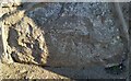
Ordnance Survey Cut Mark
This OS cut mark can be found on the wall of No2 Llysfaen Road. It marks a point 43.366m above mean sea level.
Image: © Adrian Dust
Taken: 17 Jun 2021
0.14 miles