
IMAGES TAKEN NEAR TO
Tan Y Wal, COLWYN BAY, LL29 9AW
Introduction
This page details the photographs taken nearby to Tan Y Wal, LL29 9AW by members of the Geograph project.
The Geograph project started in 2005 with the aim of publishing, organising and preserving representative images for every square kilometre of Great Britain, Ireland and the Isle of Man.

There are currently over 7.5m images from over14,400 individuals and you can help contribute to the project by visiting https://www.geograph.org.uk
Image Map
Images are licensed for reuse under creativecommons.org/licenses/by-sa/2.0
Notes
- Clicking on the map will re-center to the selected point.
- The higher the marker number, the further away the image location is from the centre of the postcode.
Image Listing (77 Images Found)
Images are licensed for reuse under creativecommons.org/licenses/by-sa/2.0
Image
Details
Distance
1

Cliff behind Glan-Y-Mor Road
Taken from near the recreation ground. Holiday apartments have now been constructed at the top of the cliff.
Image: © Darren Haddock
Taken: 17 Apr 2006
0.06 miles
2
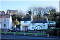
The Post Office, Abergele Road, Penmaenhead, Old Colwyn
Image: © Mike Gentry
Taken: 19 Jan 2011
0.07 miles

4
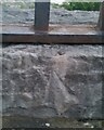
Ordnance Survey Rivet
This OS rivet can be found on the wall NW side of Abergele Road. It marks a point 73.310m above mean sea level.
Image: © Adrian Dust
Taken: 18 Jun 2021
0.08 miles
5
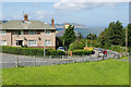
Tan-y-Lan Road, Tan-y-Lan
Part of the Tan-y-Lan estate to the east of Colwyn Bay; these were built as council houses although many are now in private ownership.
Image: © Stephen McKay
Taken: 4 Aug 2017
0.09 miles
6

Tan-Y-Lan Recreation Ground
North Wales Expressway as it crosses the railway line to the right and Colwyn Bay in the distance.
Image: © Darren Haddock
Taken: 16 Apr 2006
0.09 miles
7
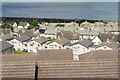
Tan-y-Lan
A view across the estate from Abergele Road.
Image: © Stephen McKay
Taken: 4 Aug 2017
0.11 miles
8
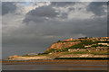
Looking towards Penmaen Head and "Rainbow Bridge"
Visible on the skyline is the Colwyn Bay Hotel (previously known as Hotel 70). This landmark is familiar to countless travellers along the A55 Expressway and this image shows it in a partly demolished state. A new development of apartments is planned on the site.
Image: © Bryn Roberts
Taken: 6 May 2007
0.12 miles
10
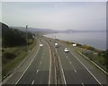
Expressway from Rainbow bridge Old Colwyn, Colwyn Bay.
Image: © colwynboy
Taken: 10 Apr 2010
0.12 miles