
IMAGES TAKEN NEAR TO
Groes Road, COLWYN BAY, LL29 8YP
Introduction
This page details the photographs taken nearby to Groes Road, LL29 8YP by members of the Geograph project.
The Geograph project started in 2005 with the aim of publishing, organising and preserving representative images for every square kilometre of Great Britain, Ireland and the Isle of Man.

There are currently over 7.5m images from over14,400 individuals and you can help contribute to the project by visiting https://www.geograph.org.uk
Image Map
Images are licensed for reuse under creativecommons.org/licenses/by-sa/2.0
Notes
- Clicking on the map will re-center to the selected point.
- The higher the marker number, the further away the image location is from the centre of the postcode.
Image Listing (4 Images Found)
Images are licensed for reuse under creativecommons.org/licenses/by-sa/2.0
Image
Details
Distance
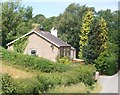
2
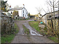
Farm buildings at Meifod
Looking up the yard at Meifod, with the farmhouse prominent on the hill. The farm track continues to other, isolated houses but is not a right of way.
Image: © Jonathan Wilkins
Taken: 31 Jan 2013
0.20 miles
3
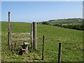
Stile and pasture
Neatly strimmed grass, a well-kept stile and pasture that has had the nettles topped. A countryside idyll! The footpath from Cefn-y-ffynnon to Parciau runs imperceptibly across the field.
Image: © Jonathan Wilkins
Taken: 19 May 2011
0.22 miles
4
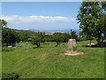
Cefn-y-ffynon trig and pasture
Triangulation pillars always have a good view, of course. From an elevation of 141 metres, there is a grand view over Colwyn Bay to Rhos on Sea and the Little Orme. The black specks just visible near the apparent horizon are a group of helicopters flying at low altitude over the town. It seemed a waste to exclude them!
Image: © Jonathan Wilkins
Taken: 19 May 2011
0.25 miles