
IMAGES TAKEN NEAR TO
Llanelian Road, COLWYN BAY, LL29 8UN
Introduction
This page details the photographs taken nearby to Llanelian Road, LL29 8UN by members of the Geograph project.
The Geograph project started in 2005 with the aim of publishing, organising and preserving representative images for every square kilometre of Great Britain, Ireland and the Isle of Man.

There are currently over 7.5m images from over14,400 individuals and you can help contribute to the project by visiting https://www.geograph.org.uk
Image Map
Images are licensed for reuse under creativecommons.org/licenses/by-sa/2.0
Notes
- Clicking on the map will re-center to the selected point.
- The higher the marker number, the further away the image location is from the centre of the postcode.
Image Listing (10 Images Found)
Images are licensed for reuse under creativecommons.org/licenses/by-sa/2.0
Image
Details
Distance
1
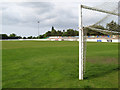
Colwyn Bay FC ground
Colwyn Bay FC rounded off an already successful 2010-11 season with victory over Flint in the North Wales Coast FA cup. I was surprised that nobody has submitted an image of the ground, so here it is. The 'new' ground was constructed on fields belonging to Parciau farm in 1984, until which time they had played in Eirias Park.
Image: © Jonathan Wilkins
Taken: 19 May 2011
0.05 miles
2
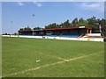
Colwyn Bay FC
Main Stand at Llanelian Road, homeground of Colwyn Bay Football Club.
Image: © AW
Taken: 9 May 2016
0.08 miles
3
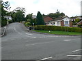
Road junction , Dolwen Road and Llanelian Road
Image: © Eirian Evans
Taken: 15 Aug 2007
0.09 miles
4
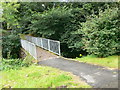
Footbridge over Nant y Ffynnon from Coed Coch Road to Ddol Ddu
Image: © Eirian Evans
Taken: 15 Aug 2007
0.14 miles
5
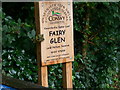
Entry to the Fairy Glen, Old Colwyn
The Fairy Glen follows the course of the river Colwyn from Coed Coch Road down to the sea. It goes through the oldest part of Old Colwyn and through the Fairy Glen Local Nature Reserve.
Image: © Eirian Evans
Taken: 15 Aug 2007
0.14 miles
6
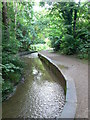
Fairy Glen, Colwyn Bay
A walk following the River Colwyn through Fairy Glen, Old Colwyn. This has been a popular walk since the 1900's. It goes under Abergele Road and down to the beach.
Image: © Eirian Evans
Taken: 15 Aug 2007
0.21 miles
7
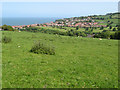
Ffridd and view to Old Colwyn
The large pasture at the top of the hill above Parciau was known as Ffridd. The rooves of Parciau can be seen in the middle distance, but the extraordinary feature of this image is that none of the development along Llanelian Road can be seen. Instead the steep Nant y Ffynnon appears to be richly wooded and it is the golf course Image which dominates the view. The Parciau land is now owned by the National Trust, but although bequeathed "in perpetuity" sales of part of the land have occurred and there was a successfully-defended planning proposal in the 1990's.
Image: © Jonathan Wilkins
Taken: 19 May 2011
0.23 miles
8
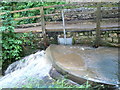
Sluice on the river Colwyn in the Fairy Glen
Image: © Eirian Evans
Taken: 15 Aug 2007
0.23 miles
9
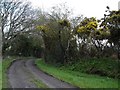
Track above Colwyn Bay
Farm track in the hills above Colwyn Bay
Image: © Dot Potter
Taken: 19 Apr 2006
0.23 miles
10
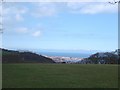
Above Colwyn Bay
Fields above the town looking down to the coast
Image: © Dot Potter
Taken: 19 Apr 2006
0.23 miles