1
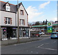
Mace shop, Abergele Road, Colwyn Bay
Part of Dingle Hill Service Station. http://www.geograph.org.uk/photo/4853776
Image: © Jaggery
Taken: 23 Feb 2016
0.01 miles
2
Dingle Hill Service Station, Colwyn Bay
BP filling station and Mace shop viewed across the A547 Abergele Road.
Image: © Jaggery
Taken: 23 Feb 2016
0.02 miles
3
Old Milestone by the A547, Abergele Road, Colwyn Bay
Set into the perimeter wall of the Methodist church grounds near the junction of Abergele Road and Nant-y-Glyn Road. Pre-dates the 1876-9 O.S. map.
Inscription reads:- : TO / ABERGELE / 6 MILES / TO / CONWAY / 5 MILES / 6 FUR :
Milestone Society National ID: DEN_AGCY06
Image: © Peter Frederick Williams
Taken: 28 May 2020
0.02 miles
4
Detached houses, Abergele Road, Colwyn Bay
Viewed from the corner of Nant-y-Glyn Road.
Image: © Jaggery
Taken: 23 Feb 2016
0.03 miles
5
The Park pub, Colwyn Bay
Nant-y-Glyn Road side of the pub on the corner of Abergele Road.
Image: © Jaggery
Taken: 23 Feb 2016
0.03 miles
6
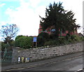
North side of Nant-y-Glyn Methodist Church partly hidden by a tree, Colwyn Bay
On the corner of Abergele Road and Nant-y-Glyn Road. The entrance gate on the left is padlocked,
so this is the best view of this side of the church obtainable today.
Image: © Jaggery
Taken: 23 Feb 2016
0.03 miles
7
Colwyn Bay - Nant-y-Glyn Methodist Church
After walking under the railway line and up the Dingle from the sea front, you come to Nant-y-Glyn Methodist Church.
Image: © Neil Kennedy
Taken: 29 Jul 2002
0.04 miles
8
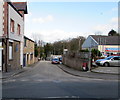
The Dingle, Colwyn Bay
Dead-end street extending for 90 metres from Abergele Road.
Image: © Jaggery
Taken: 23 Feb 2016
0.04 miles
9
Body Art Studio, Colwyn Bay
Tattoo and piercing parlour at 135A Abergele Road.
Image: © Jaggery
Taken: 23 Feb 2016
0.04 miles
10
Abergele Road bridge over a stream, Colwyn Bay
The bridge carries the A547 Abergele Road over the stream named Nant-y-Groes.
Image: © Jaggery
Taken: 23 Feb 2016
0.05 miles


