1
Lane linking Seaview Road and Ivy Street, Colwyn Bay
The 1957 Ordnance Survey map indicates that there was a public lavatory on the right of this lane. Fortunately it is no longer in use.
Image: © John S Turner
Taken: 18 Mar 2017
0.01 miles
2
Duckworths of Colwyn Bay
Located on the corner of Abergele Road and Ivy Street, Duckworths
sells souvenirs, tobacco products, watches, jewellery, fancy goods etc.
Image: © Jaggery
Taken: 23 Feb 2016
0.01 miles
3
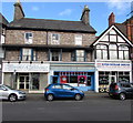
Duckworths, Colwyn Bay
Duckworths' shop on the corner of Ivy Street and Abergele Road, Colwyn Bay.
Image: © John S Turner
Taken: 18 Mar 2017
0.01 miles
4
Bon Appetit! Colwyn Bay
Sandwich bar at 13 Abergele Road.
Image: © Jaggery
Taken: 23 Feb 2016
0.01 miles
5
Efes Kebab House, Colwyn Bay
Takeaway at 19 Abergele Road. Masala Indian takeaway is on the left, Diamond Nails on the right.
Image: © Jaggery
Taken: 23 Feb 2016
0.01 miles
6
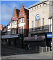
Electricity sub-station, Ivy Street, Colwyn bay
This impressive red-brick building in Ivy Street is recorded as an electricity sub station on the 1986-9 Ordnance Survey map.
Image: © John S Turner
Taken: 18 Mar 2017
0.01 miles
7
Masala Indian takeaway, Colwyn Bay
Masala Indian takeaway at 17A Abergele Road is flanked by Rooms & Blooms and Efes Kebab House.
Image: © Jaggery
Taken: 23 Feb 2016
0.01 miles
8
Former A&A Cash and Carry, Abergele Road, Colwyn Bay
In February 2016, a For Sale board is on the derelict shop at 7 Abergele Road.
Image: © Jaggery
Taken: 23 Feb 2016
0.02 miles
9
North Clwyd Animal Rescue charity shop, Colwyn Bay
The charity shop on the right is at 28 Abergele Road.
North Clwyd Animal Rescue is a registered charity founded in 1978 by Anne Owen.
Also in view are Diamond Nails and Efes Kebab House.
Image: © Jaggery
Taken: 23 Feb 2016
0.02 miles
10
Electricity power station, Ivy Street, Colwyn Bay.
This building housed the Police & Fire Stations of Colwyn Bay in the towns’ infancy.
Image: © colwynboy
Taken: 3 Jan 2010
0.02 miles


