
IMAGES TAKEN NEAR TO
Woodland Park West, COLWYN BAY, LL29 7DR
Introduction
This page details the photographs taken nearby to Woodland Park West, LL29 7DR by members of the Geograph project.
The Geograph project started in 2005 with the aim of publishing, organising and preserving representative images for every square kilometre of Great Britain, Ireland and the Isle of Man.

There are currently over 7.5m images from over14,400 individuals and you can help contribute to the project by visiting https://www.geograph.org.uk
Image Map
Images are licensed for reuse under creativecommons.org/licenses/by-sa/2.0
Notes
- Clicking on the map will re-center to the selected point.
- The higher the marker number, the further away the image location is from the centre of the postcode.
Image Listing (332 Images Found)
Images are licensed for reuse under creativecommons.org/licenses/by-sa/2.0
Image
Details
Distance
1
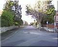
Rivieres Avenue, Colwyn Bay.
Named after Jules Riviere, the 19th century French composer.
Image: © colwynboy
Taken: 3 Jan 2010
0.02 miles
2
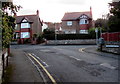
Houses opposite Woodland Road West, Colwyn Bay
The southern end of Woodland Road West, 200 metres southwest of the A547.
Image: © Jaggery
Taken: 23 Feb 2016
0.04 miles
3
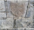
Ordnance Survey Cut Mark
This OS cut mark can be found on the wall at the junction of Coed Pella Road & Woodland Park. It marks a point 40.709m above mean sea level.
Image: © Adrian Dust
Taken: 14 Sep 2019
0.04 miles
4
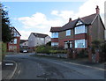
Rivieres Avenue house, Colwyn Bay
The house on the right is on the corner of Woodland Park.
Image: © Jaggery
Taken: 23 Feb 2016
0.04 miles
5
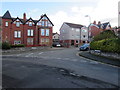
Junction of Woodland Park and Rivieres Avenue, Colwyn Bay
The Woodland Park name sign is on the left.
The Rivieres Avenue name sign is below the hedge on the right.
Image: © Jaggery
Taken: 23 Feb 2016
0.05 miles
6
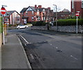
No Entry signs, Woodland Road East, Colwyn Bay
Facing Woodland Road East at the Woodland Park junction. The car is on the corner of York Road.
Image: © Jaggery
Taken: 23 Feb 2016
0.06 miles
7
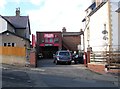
Car Care, Colwyn Bay
Garage at 24 Woodland Road East, opposite York Road.
Image: © Jaggery
Taken: 23 Feb 2016
0.06 miles
8

Colwyn Bay Spiritualist Meeting House
Located in the blue house at 17 Woodland Road West.
Image: © Jaggery
Taken: 23 Feb 2016
0.08 miles
9
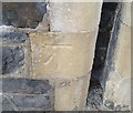
Ordnance Survey Cut Mark
This OS cut mark can be found on the wall between Nos6 & 8 Coed Pella Road. It marks a point 29.551m above mean sea level.
Image: © Adrian Dust
Taken: 14 Sep 2019
0.08 miles
10
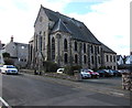
Former Engedi chapel, Woodland Road West, Colwyn Bay
In February 2016, there is no name sign in view to indicate the current usage, if any, of the former
Engedi Welsh Calvinistic Methodist Church which dates from 1879, rebuilt in 1898, closed down in 1987.
Image: © Jaggery
Taken: 23 Feb 2016
0.09 miles