
IMAGES TAKEN NEAR TO
Queens Drive, COLWYN BAY, LL29 7BH
Introduction
This page details the photographs taken nearby to Queens Drive, LL29 7BH by members of the Geograph project.
The Geograph project started in 2005 with the aim of publishing, organising and preserving representative images for every square kilometre of Great Britain, Ireland and the Isle of Man.

There are currently over 7.5m images from over14,400 individuals and you can help contribute to the project by visiting https://www.geograph.org.uk
Image Map
Images are licensed for reuse under creativecommons.org/licenses/by-sa/2.0
Notes
- Clicking on the map will re-center to the selected point.
- The higher the marker number, the further away the image location is from the centre of the postcode.
Image Listing (173 Images Found)
Images are licensed for reuse under creativecommons.org/licenses/by-sa/2.0
Image
Details
Distance
1
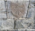
Ordnance Survey Cut Mark
This OS cut mark can be found on the wall at the junction of Coed Pella Road & Woodland Park. It marks a point 40.709m above mean sea level.
Image: © Adrian Dust
Taken: 14 Sep 2019
0.08 miles
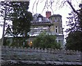
3
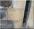
Ordnance Survey Cut Mark
This OS cut mark can be found on the wall between Nos6 & 8 Coed Pella Road. It marks a point 29.551m above mean sea level.
Image: © Adrian Dust
Taken: 14 Sep 2019
0.09 miles
5
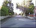
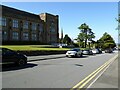
Rivieres Avenue, Colwyn Bay.
Named after Jules Riviere, the 19th century French composer.
Image: © colwynboy
Taken: 3 Jan 2010
0.12 miles
7
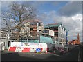
New council offices, Coed Pella Road
Construction advancing on the new council offices. It hardly seems possible that more than 12 months have elapsed since my images of demolition were posted (see Image). While the road layout suffers only temporary upset, the scene is so radically changed that reminders are necessary of the old order, such as the mature tree and distant, diminished spire of the English Presbyterian church.
Image: © Jonathan Wilkins
Taken: 31 Jan 2018
0.12 miles
8
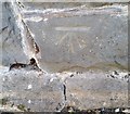
Ordnance Survey Cut Mark
This OS cut mark can be found on the wall SE side of Pwllycrochan Avenue. It marks a point 33.688m above mean sea level.
Image: © Adrian Dust
Taken: 14 Sep 2019
0.12 miles
10
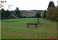
Rydal Gardens, Colwyn Bay
Park in the middle of Colwyn Bay, with the building of Rydal School at the top.
Image: © Eirian Evans
Taken: 16 Nov 2007
0.13 miles