
IMAGES TAKEN NEAR TO
Oakwood, COLWYN BAY, LL29 7AE
Introduction
This page details the photographs taken nearby to Oakwood, LL29 7AE by members of the Geograph project.
The Geograph project started in 2005 with the aim of publishing, organising and preserving representative images for every square kilometre of Great Britain, Ireland and the Isle of Man.

There are currently over 7.5m images from over14,400 individuals and you can help contribute to the project by visiting https://www.geograph.org.uk
Image Map
Images are licensed for reuse under creativecommons.org/licenses/by-sa/2.0
Notes
- Clicking on the map will re-center to the selected point.
- The higher the marker number, the further away the image location is from the centre of the postcode.
Image Listing (28 Images Found)
Images are licensed for reuse under creativecommons.org/licenses/by-sa/2.0
Image
Details
Distance
2
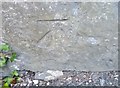
Ordnance Survey Cut Mark
This OS cut mark can be found on the wall Ne side of Kings Drive. It marks a point 73.791m above mean sea level.
Image: © Adrian Dust
Taken: 14 Sep 2019
0.08 miles
3
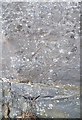
Ordnance Survey Cut Mark
This OS cut mark can be found on the wall east side of Kings Road. It marks a point 51.111m above mean sea level.
Image: © Adrian Dust
Taken: 14 Sep 2019
0.12 miles
4
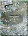
Ordnance Survey Cut Mark
This OS cut mark can be found on the wall north side of Old Highway. It marks a point 84.447m above mean sea level.
Image: © Adrian Dust
Taken: 14 Sep 2019
0.12 miles
5
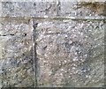
Ordnance Survey Cut Mark
This OS cut mark can be found on the wall of No47 Pwllycrochan Avenue. It marks a point 65.839m above mean sea level.
Image: © Adrian Dust
Taken: 14 Sep 2019
0.12 miles
7
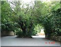
Pwllycrochan Avenue - Colwyn Bay
The avenue is split in two by the tree growing in the middle of the road.
Image: © Dot Potter
Taken: 10 Sep 2005
0.14 miles
9
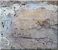
Ordnance Survey Cut Mark
This OS cut mark can be found on the wall of No39 Pwllycrochan Avenue. It marks a point 48.767m above mean sea level.
Image: © Adrian Dust
Taken: 14 Sep 2019
0.14 miles
10
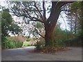
Coeden yng Nghanol Pwllycrochan Road / Tree in the middle of Pwllycrochan Road
Image: © Ceri Thomas
Taken: 2 Jan 2010
0.16 miles