
IMAGES TAKEN NEAR TO
Gerddi Victoria, COLWYN BAY, LL29 6DQ
Introduction
This page details the photographs taken nearby to Gerddi Victoria, LL29 6DQ by members of the Geograph project.
The Geograph project started in 2005 with the aim of publishing, organising and preserving representative images for every square kilometre of Great Britain, Ireland and the Isle of Man.

There are currently over 7.5m images from over14,400 individuals and you can help contribute to the project by visiting https://www.geograph.org.uk
Image Map
Images are licensed for reuse under creativecommons.org/licenses/by-sa/2.0
Notes
- Clicking on the map will re-center to the selected point.
- The higher the marker number, the further away the image location is from the centre of the postcode.
Image Listing (13 Images Found)
Images are licensed for reuse under creativecommons.org/licenses/by-sa/2.0
Image
Details
Distance
1
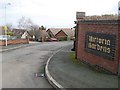
Victoria Gardens
Densely interlocked bungalows at the eastern end of Rhodfa'r Grug.
Image: © Jonathan Wilkins
Taken: 6 Feb 2019
0.03 miles
2
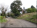
Pen-y-bryn Road 2
Land to the south of the road was originally the Colwyn Bay Golf Course, being purchased by the council and re-sold for residential development between 1958 and 1960. Some plots are still being developed (or re-developed)!
Image: © Jonathan Wilkins
Taken: 6 Feb 2019
0.06 miles
3
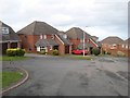
Rhodfa'r Grug 2
Two-storey houses at the distal end of the network. Fashionable, modern houses have burgeoned where once the Colwyn Bay Golf Course was situated.
Image: © Jonathan Wilkins
Taken: 6 Feb 2019
0.08 miles
4
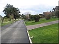
Pen-y-bryn Road 3
The upper part of the road is paved, and the area has a luxurious aura with its manicured gardens and mature plantings. Sea views are obtained by building at a distance from the southern side of the road.
Image: © Jonathan Wilkins
Taken: 6 Feb 2019
0.12 miles
5
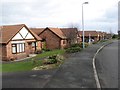
Rhodfa'r Grug 1
Bungalows on Rhofa'r Grug, part of the fashionable, Upper Colwyn Bay area. Now that cars are taken for granted, the steepness of the road and distance from the town centre are not obstacles.
Image: © Jonathan Wilkins
Taken: 6 Feb 2019
0.13 miles
6
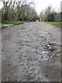
Rocky road
Most of Pen-y-bryn Road to the east of King's Drive is unpaved. The steep local terrain is evidenced by rock outcrop forming part of the road surface in some places, much smoothed by traffic over hundreds of years.
Image: © Jonathan Wilkins
Taken: 6 Feb 2019
0.18 miles
7
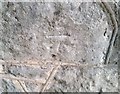
Ordnance Survey Cut Mark
This OS cut mark can be found on the wall of No28 Woodland Park. It marks a point 76.001m above mean sea level.
Image: © Adrian Dust
Taken: 14 Sep 2019
0.18 miles
8
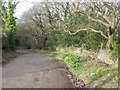
Pen-y-bryn Road 1
Pen-y-bryn Road was previously the only alternative to the exceedingly steep descent of the Llanrwst Road, being by-passed by 1914 by the equally steep King's Drive. Most of the road is not paved, as seen here descending through the woods.
Image: © Jonathan Wilkins
Taken: 6 Feb 2019
0.20 miles
9
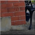
Ordnance Survey Cut Mark
This OS cut mark can be found on No28 Seafield Road. It marks a point 72.057m above mean sea level.
Image: © Adrian Dust
Taken: 14 Sep 2019
0.22 miles
10
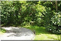
Pwllycrochan Woods
The eastern end of Pen-y-Bryn road is no more than a track winding down through the woods.
Image: © Stephen McKay
Taken: 7 Aug 2017
0.22 miles