
IMAGES TAKEN NEAR TO
West End, COLWYN BAY, LL28 5TB
Introduction
This page details the photographs taken nearby to West End, LL28 5TB by members of the Geograph project.
The Geograph project started in 2005 with the aim of publishing, organising and preserving representative images for every square kilometre of Great Britain, Ireland and the Isle of Man.

There are currently over 7.5m images from over14,400 individuals and you can help contribute to the project by visiting https://www.geograph.org.uk
Image Map
Images are licensed for reuse under creativecommons.org/licenses/by-sa/2.0
Notes
- Clicking on the map will re-center to the selected point.
- The higher the marker number, the further away the image location is from the centre of the postcode.
Image Listing (42 Images Found)
Images are licensed for reuse under creativecommons.org/licenses/by-sa/2.0
Image
Details
Distance
1
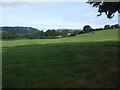
View across Gala Field Glan Conwy towards Deganwy
The field has been identified as a potential housing development site as a part of the local authorities future plans. Image]
Image: © Richard Hoare
Taken: 8 Aug 2009
0.04 miles
2
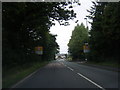
A470 approaching Llansanffraid Glan Conwy
Image: © Colin Pyle
Taken: 27 Jun 2011
0.06 miles
3
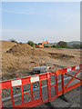
Trial pit
Land which has been cleared for development has been dug to provide a rock sample for geotechnical investigation. This site is underlain almost entirely by more or less solid rock, which is a weathered and cleaved mudstone of Silurian age. See Image for more detail.
Image: © Jonathan Wilkins
Taken: 20 Apr 2011
0.06 miles
4
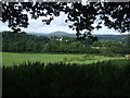
View across Gala Field Glan Conwy towards Tal y Fan
The field in question has been designated as a potential housing development site as a part of the local authority plans.The A470 runs through the glade at the bottom of the field.Image]
Image: © Richard Hoare
Taken: 8 Aug 2009
0.08 miles
5

A newly built house near Glan Conwy
Presumably the portaloo is not in the final plan.
Image: © David Medcalf
Taken: 3 Mar 2025
0.10 miles
6

New houses near Glan Conwy
A 'new build' estate on former farmland.
Image: © David Medcalf
Taken: 3 Mar 2025
0.11 miles
7
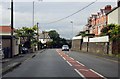
Llanrwst Road in Glan Conwy
The A470, also known as the Cardiff to Glan Conwy Trunk Road, is the major long-distance road in Wales, from Cardiff on the south coast to Llandudno on the north coast.
Image: © Steve Daniels
Taken: 23 Aug 2015
0.11 miles
8
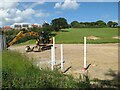
Birth of a housing estate 2
Topsoil removal and ground investigation pits are the first signs of a new housing estate getting under way. Planning permission was granted in November 2020 for the Maes y Felin development of 107 houses despite heated debate on the provision of affordable homes and traffic management measures. Houses on the most recent extension of the village look down from the brow of the hill.
Image: © Jonathan Wilkins
Taken: 10 Jun 2022
0.12 miles
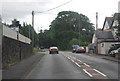
10
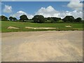
Birth of a housing estate 1
Topsoil removal and ground investigation pits are the first signs of a new housing estate getting under way. Planning permission was granted in November 2020 for the Maes y Felin development of 107 houses despite heated debate on the provision of affordable homes and traffic management measures.
Image: © Jonathan Wilkins
Taken: 10 Jun 2022
0.16 miles