
IMAGES TAKEN NEAR TO
Bryn Eglwys, COLWYN BAY, LL28 4YY
Introduction
This page details the photographs taken nearby to Bryn Eglwys, LL28 4YY by members of the Geograph project.
The Geograph project started in 2005 with the aim of publishing, organising and preserving representative images for every square kilometre of Great Britain, Ireland and the Isle of Man.

There are currently over 7.5m images from over14,400 individuals and you can help contribute to the project by visiting https://www.geograph.org.uk
Image Map
Images are licensed for reuse under creativecommons.org/licenses/by-sa/2.0
Notes
- Clicking on the map will re-center to the selected point.
- The higher the marker number, the further away the image location is from the centre of the postcode.
Image Listing (80 Images Found)
Images are licensed for reuse under creativecommons.org/licenses/by-sa/2.0
Image
Details
Distance
1
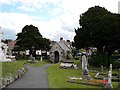
Churchyard at Llandrillo yn Rhos
The churchyard looking at the parish church at Llandrillo yn Rhos
Image: © Dot Potter
Taken: 13 Aug 2005
0.06 miles
2
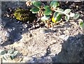
Ordnance Survey OSBM Bolt
This OS Bolt can be found on a rock in a garden SW side of the road. It marks a point 40.865m above mean sea level.
Image: © Adrian Dust
Taken: 14 Sep 2019
0.10 miles
5
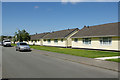
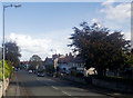
Elwy Road, Rhos on Sea
There are 26 bungalows on the north side of Elwy Road offering retirement accommodation for residents aged 60 or over. They were built in 1965.
Image: © Stephen McKay
Taken: 4 Aug 2017
0.12 miles
6
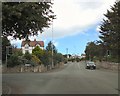
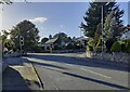
Rhos Road Crossroads
At the crossroads with Rhos Road, the B5115 changes from Brompton Avenue into Llandudno Road.
Image: © Gerald England
Taken: 6 Jul 2014
0.12 miles
7
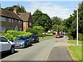
Bryn Eglwys, Llandrillo-yn-Rhôs
Postwar housing development.
Image: © Alan Murray-Rust
Taken: 22 Jun 2024
0.13 miles
8
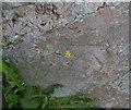
Ordnance Survey Cut Mark
This OS cut mark can be found on the wall NW side of Rhos Road. It marks a point 26.009m above mean sea level.
Image: © Adrian Dust
Taken: 14 Sep 2019
0.13 miles
9
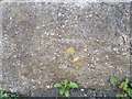
Ordnance Survey Cut Mark
This OS cut mark can be found on the wall of Navarre, Church Road. It marks a point 27.977m above mean sea level.
Image: © Adrian Dust
Taken: 14 Sep 2019
0.14 miles
10
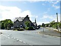
The former Ship Hotel, Llandrillo (2)
Now known as Hickory's Smokehouse (an American diner), this was formerly the Ship Hotel Image, a name that appeared on maps from 1900 or earlier. Whatpub.com gives the date of the name change as March 2014. The bus stop across the road still uses the old name.
Image: © Stephen Craven
Taken: 22 Jun 2024
0.15 miles