IMAGES TAKEN NEAR TO
Llannerch Road East, COLWYN BAY, LL28 4DH

Introduction

This page details the photographs taken nearby to Llannerch Road East, LL28 4DH by members of the Geograph project.

The Geograph project started in 2005 with the aim of publishing, organising and preserving representative images for every square kilometre of Great Britain, Ireland and the Isle of Man.

There are currently over 7.5m images from over14,400 individuals and you can help contribute to the project by visiting https://www.geograph.org.uk

Image Map


Images are licensed for reuse under creativecommons.org/licenses/by-sa/2.0
Notes
  • Clicking on the map will re-center to the selected point.
  • The higher the marker number, the further away the image location is from the centre of the postcode.

Image Listing (57 Images Found)

Images are licensed for reuse under creativecommons.org/licenses/by-sa/2.0
  • ...
Image
Details
Distance
1
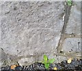
Ordnance Survey Cut Mark
This OS cut mark can be found on the wall east side of Brompton Avenue. It marks a point 19.990m above mean sea level.
Image: © Adrian Dust Taken: 14 Sep 2019
0.05 miles
2
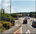
End of the B5115
The traffic lights are at the end of the B5115 from Llandudno. The road crosses the A55 and joins the A547.
Image: © Gerald England Taken: 10 Jul 2014
0.09 miles
3
View east from Bryn Euryn
Looking across Colwyn Bay, with the transport corridor of the railway line and A55 trunk road just right of centre.
Image: © Stephen Craven Taken: 22 Jun 2024
0.09 miles
4
Waiting at the lights
Image: © Steve Fareham Taken: 18 Jan 2016
0.09 miles
5
Bridge over the A55, Colwyn Bay
Image: © N Chadwick Taken: 24 Jun 2012
0.09 miles
6
Conwy Road School, West End, Colwyn Bay
Image: © colwynboy Taken: 1 Jan 2010
0.11 miles
7
Ordnance Survey Flush Bracket (G2838)
This OS Flush Bracket can be found on No168 Conway Road. It marks a point 24.345m above mean sea level.
Image: © Adrian Dust Taken: 14 Sep 2019
0.11 miles
8
Brompton Avenue
Image: © Steve Fareham Taken: 18 Jan 2016
0.12 miles
9
Ordnance Survey Cut Mark
This OS cut mark can be found on the school wall south side of Conway Road. It marks a point 24.541m above mean sea level.
Image: © Adrian Dust Taken: 14 Sep 2019
0.12 miles
10
Broadway from Whitehall Road
Looking across the roundabout on Llandudno Road.
Image: © Gerald England Taken: 10 Jul 2014
0.13 miles
  • ...