IMAGES TAKEN NEAR TO
Maes Ebberston Place, COLWYN BAY, LL28 4BF

Introduction

This page details the photographs taken nearby to Maes Ebberston Place, LL28 4BF by members of the Geograph project.

The Geograph project started in 2005 with the aim of publishing, organising and preserving representative images for every square kilometre of Great Britain, Ireland and the Isle of Man.

There are currently over 7.5m images from over14,400 individuals and you can help contribute to the project by visiting https://www.geograph.org.uk

Image Map


Images are licensed for reuse under creativecommons.org/licenses/by-sa/2.0
Notes
  • Clicking on the map will re-center to the selected point.
  • The higher the marker number, the further away the image location is from the centre of the postcode.

Image Listing (55 Images Found)

Images are licensed for reuse under creativecommons.org/licenses/by-sa/2.0
  • ...
Image
Details
Distance
1
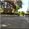
Tan-Y-Bryn Road
Horton drive on the left
Image: © Jim Smillie Taken: 13 May 2022
0.05 miles
2
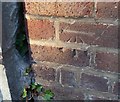
Ordnance Survey Cut Mark
This OS cut mark can be found on the wall of No53 Brompton Avenue. It marks a point 23.042m above mean sea level.
Image: © Adrian Dust Taken: 14 Sep 2019
0.15 miles
3
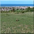
Open area: Bryn Euryn
With view over Rhos on Sea
Image: © Jim Smillie Taken: 13 May 2022
0.16 miles
4
Steps up Bryn Euryn
The main path up the hill from Rhos-on-Sea.
Image: © Stephen Craven Taken: 22 Jun 2024
0.17 miles
5
Rockface on the path around Bryn Euryn
Some of the limestone strata forming the hill can be seen in this outcrop.
Image: © Stephen Craven Taken: 22 Jun 2024
0.17 miles
6
Bryn Euryn
Limestone grassland below the top of Bryn Euryn with Rhos-on-Sea in the background.
Image: © Ian Capper Taken: 22 Jun 2024
0.20 miles
7
Ordnance Survey Cut Mark
This OS cut mark can be found on the wall between Nos63 & 65 Brompton Avenue. It marks a point 26.677m above mean sea level.
Image: © Adrian Dust Taken: 14 Sep 2019
0.20 miles
8
Cleared scrub
Clearance of scrub is part of the management of the nature reserve because grazing animals are not part of the local plan. The work to improve biodiversity through reducing scrub and introduced invasive species will help restore rare limestone grassland on this SSSI facilitated by the Nature Networks Fund.
Image: © Jonathan Wilkins Taken: 12 Dec 2022
0.21 miles
9
Broadway, Linking Brompton roundabout & Llannerch Rd, West End, Colwyn Bay.
Image: © colwynboy Taken: 8 Apr 2010
0.21 miles
10
Bryn Euryn
Limestone grassland below the top of Bryn Euryn with Rhos-on-Sea in the background.
Image: © Ian Capper Taken: 22 Jun 2024
0.21 miles
  • ...