
IMAGES TAKEN NEAR TO
LLANRWST, LL26 0YY
Introduction
This page details the photographs taken nearby to LL26 0YY by members of the Geograph project.
The Geograph project started in 2005 with the aim of publishing, organising and preserving representative images for every square kilometre of Great Britain, Ireland and the Isle of Man.

There are currently over 7.5m images from over14,400 individuals and you can help contribute to the project by visiting https://www.geograph.org.uk
Image Map
Images are licensed for reuse under creativecommons.org/licenses/by-sa/2.0
Notes
- Clicking on the map will re-center to the selected point.
- The higher the marker number, the further away the image location is from the centre of the postcode.
Image Listing (6 Images Found)
Images are licensed for reuse under creativecommons.org/licenses/by-sa/2.0
Image
Details
Distance
1
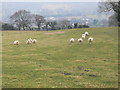
Sheep on a hillside above Llanrwst
Llanrwst is seen in the valley below.
Image: © Eirian Evans
Taken: 18 Feb 2010
0.15 miles
2
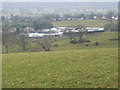
Caravan storage at Bronderw
Bronderw farm in Llanrwst has a caravan site and also a "garage mort" - winter storage area for caravans.
Image: © Eirian Evans
Taken: 18 Feb 2010
0.18 miles
3
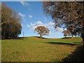
Pasture with woodland
A park-like setting for specimen oak trees beyond the margin of a wooded hillside. Once again, the inconsiderate intrusion of a power transmission line is noted.
Image: © Jonathan Wilkins
Taken: 4 Dec 2016
0.19 miles
4
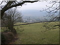
View towards Llanrwst
Taken from a track leading from Felin Uchaf to Llanddoged.
Image: © Eirian Evans
Taken: 18 Feb 2010
0.24 miles
5
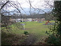
Playground near Cae Tyddyn Estate, Llanrwst
Image: © Eirian Evans
Taken: 18 Feb 2010
0.25 miles
6
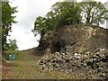
Sandstone quarry
A quarry which has obviously produced a significant quantity of useful building stone from the Denbigh Grits, of Silurian age. Inter-bedded mudstones can be seen clearly in the upper part of the quarry face.
Image: © Jonathan Wilkins
Taken: 12 May 2018
0.25 miles