
IMAGES TAKEN NEAR TO
Llanddoged Road, LLANRWST, LL26 0YT
Introduction
This page details the photographs taken nearby to Llanddoged Road, LL26 0YT by members of the Geograph project.
The Geograph project started in 2005 with the aim of publishing, organising and preserving representative images for every square kilometre of Great Britain, Ireland and the Isle of Man.

There are currently over 7.5m images from over14,400 individuals and you can help contribute to the project by visiting https://www.geograph.org.uk
Image Map
Images are licensed for reuse under creativecommons.org/licenses/by-sa/2.0
Notes
- Clicking on the map will re-center to the selected point.
- The higher the marker number, the further away the image location is from the centre of the postcode.
Image Listing (54 Images Found)
Images are licensed for reuse under creativecommons.org/licenses/by-sa/2.0
Image
Details
Distance
2
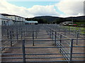
Pens at the Livestock market
Business must have been brisk as the pens are empty but the surrounding roads still have plenty of 4x4's and trailers parked up.
The auctioneers chant could however still be heard in the background.
Maybe not as quick as http://www.youtube.com/watch?v=BshGX4YD5Rc
Image: © Richard Hoare
Taken: 19 Sep 2012
0.17 miles
3
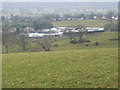
Caravan storage at Bronderw
Bronderw farm in Llanrwst has a caravan site and also a "garage mort" - winter storage area for caravans.
Image: © Eirian Evans
Taken: 18 Feb 2010
0.17 miles
4
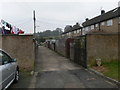
Back lane at Cae Tyddyn estate, Llanrwst
Image: © Eirian Evans
Taken: 18 Feb 2010
0.17 miles
5
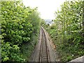
The line to Llanrwst
From the road bridge on A470.
Image: © Richard Hoare
Taken: 17 May 2015
0.18 miles
6
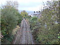
Railway line through Llanrwst
For the line between Llandudno Junction and Blaenau Ffestiniog.
Image: © Eirian Evans
Taken: 2 Nov 2010
0.18 miles
7
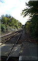
Down the line towards Llanrwst - south
From the semi-redundant, Grade II listed building, at Llanrwst North station.
Here the passing loop through the station reverts back to single track.
You are allowed to cross from one platform to another using the Stop, Look, Listen walkway.
Image: © Richard Hoare
Taken: 26 Oct 2012
0.19 miles
8
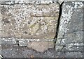
Ordnance Survey Cut Mark
This OS cut mark can be found on the SE parapet of the railway bridge. It marks a point 12.737m above mean sea level.
Image: © Adrian Dust
Taken: 20 Jun 2021
0.20 miles
9
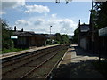
Llanrwst North Railway Station facing SSE
Now a request halt.
Image: © Richard Hoare
Taken: 11 Sep 2009
0.20 miles
10

The Queens Hotel Llanrwst
Yet another redundant pub / hotel.
Image: © Richard Hoare
Taken: 26 Oct 2012
0.20 miles