
IMAGES TAKEN NEAR TO
Maenan, LLANRWST, LL26 0YR
Introduction
This page details the photographs taken nearby to LL26 0YR by members of the Geograph project.
The Geograph project started in 2005 with the aim of publishing, organising and preserving representative images for every square kilometre of Great Britain, Ireland and the Isle of Man.

There are currently over 7.5m images from over14,400 individuals and you can help contribute to the project by visiting https://www.geograph.org.uk
Image Map
Images are licensed for reuse under creativecommons.org/licenses/by-sa/2.0
Notes
- Clicking on the map will re-center to the selected point.
- The higher the marker number, the further away the image location is from the centre of the postcode.
Image Listing (24 Images Found)
Images are licensed for reuse under creativecommons.org/licenses/by-sa/2.0
Image
Details
Distance
2
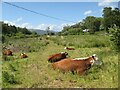
Peaceful cows
Cows with their young calves are enjoying the spring sunshine on the rough meadows adjacent to the railway and A470 by Dolgarrog Station. Compare with a previous view during preparation for railway works: Image
Image: © Jonathan Wilkins
Taken: 10 Jun 2022
0.14 miles
3
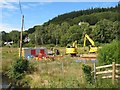
Access to the railway
The first sunshine for many days has illuminated a colourful scene by Dolgarrog Station. A temporary access road has been constructed to enable access to the railway formation some distance to the north.
Extended closure of the railway and lack of imperative for re-opening due to Covid-19 restrictions has led to a major engineering campaign to enhance the flood-resistance of the line.
Image: © Jonathan Wilkins
Taken: 11 Jul 2020
0.15 miles
4
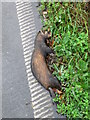
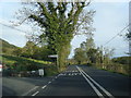
Polecat, R.I.P.
A dead polecat by the side of the A470.
Image: © Eirian Evans
Taken: 2 Nov 2010
0.15 miles
6
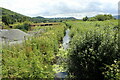
Stream at Dalgorrog Station
Viewed from a culvert. This area is prone to flooding and much work has been undertaken to reduce the risk. The adjacent rail line has been strengthened in a considerable number of places with rock armour.
Image: © Richard Hoare
Taken: 26 Jun 2023
0.16 miles
7
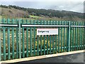
Dolgarrog station sign
Viewed from the train bound for Llandudno from Blaenau Ffestiniog.
Image: © Richard Hoare
Taken: 8 Apr 2024
0.16 miles
9
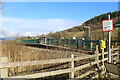
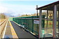
Dolgarrog station viewed from the footpath
The footpath is signed as 'closed'. The reason being about 200 metres behind the photographer is a bridge Image] across the river which is closed for safety reasons.
Moves are in hand to have the bridge repaired. In theory this must be the only village which has a station but it cannot be reached unless a long circuitous route is taken by road.
Equally it is a station without a village.
Image: © Richard Hoare
Taken: 1 Feb 2022
0.16 miles
10

Information board at Dolgarrog station
Deals with Covid rules and the announcement of a replacement bus service.
The Conwy Valley Line which runs between Blaenau Ffestiniog and Llandudno did not reopen on 28 January as expected, and a bus replacement service will operate until further notice.
The line, which runs from Blaenau Ffestiniog to Llandudno, had closed again on Tuesday, 19 January following flood damage caused by Storm Christoph. This is coupled with staff shortages.
Image: © Richard Hoare
Taken: 1 Feb 2022
0.16 miles