
IMAGES TAKEN NEAR TO
Capel Curig, BETWS-Y-COED, LL24 0EA
Introduction
This page details the photographs taken nearby to LL24 0EA by members of the Geograph project.
The Geograph project started in 2005 with the aim of publishing, organising and preserving representative images for every square kilometre of Great Britain, Ireland and the Isle of Man.

There are currently over 7.5m images from over14,400 individuals and you can help contribute to the project by visiting https://www.geograph.org.uk
Image Map
Images are licensed for reuse under creativecommons.org/licenses/by-sa/2.0
Notes
- Clicking on the map will re-center to the selected point.
- The higher the marker number, the further away the image location is from the centre of the postcode.
Image Listing (80 Images Found)
Images are licensed for reuse under creativecommons.org/licenses/by-sa/2.0
Image
Details
Distance
1
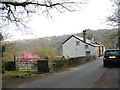
Houses in the former quarrying hamlet of Pont Cyfyng
Image: © Eric Jones
Taken: 21 Apr 2007
0.03 miles
4
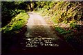
Signwriting on the road to Rh?s
It takes a moment to work out what's wrong (well, it did for me, anyway)
Image: © Richard Law
Taken: Unknown
0.06 miles
5
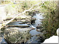
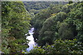
Top of the Cyfyng Falls at a period of depleted water flow
Image: © Eric Jones
Taken: 21 Apr 2007
0.07 miles
6
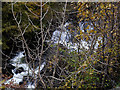
Waterfall through the trees
On the Afon Llugwy below Pont Cyfyng.
Image: © Nigel Brown
Taken: 1 Nov 2010
0.07 miles
7
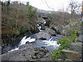
Afon Llugwy
Bridge towards Pont Cyfyng at top of Cyfyng Falls
Image: © Hugh Venables
Taken: 20 Apr 2006
0.07 miles
8
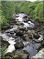
Afon Llugwy from Pont Cyfyng
View of River Llugwy looking west from Cyfyng bridge, adjacent to the A5 approximately 1.5km SE of Capel Curig
Image: © Pete Wise
Taken: 1 Sep 2007
0.07 miles
9
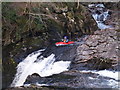
Cyfyng Falls
A kayaker braving the Cyfyng Falls.
Image: © Chris McAuley
Taken: 4 Mar 2012
0.08 miles
10
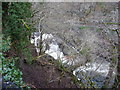
Part of Pont Cyfyng Falls in winter
The view of the falls, even in winter, is partly obstructed by trees. The A5 road passes by on the far bank. The speed limit signs give scale.
Image: © Jeremy Bolwell
Taken: 20 Jan 2012
0.09 miles