
IMAGES TAKEN NEAR TO
Church Street, BALA, LL23 7UA
Introduction
This page details the photographs taken nearby to Church Street, LL23 7UA by members of the Geograph project.
The Geograph project started in 2005 with the aim of publishing, organising and preserving representative images for every square kilometre of Great Britain, Ireland and the Isle of Man.

There are currently over 7.5m images from over14,400 individuals and you can help contribute to the project by visiting https://www.geograph.org.uk
Image Map
Images are licensed for reuse under creativecommons.org/licenses/by-sa/2.0
Notes
- Clicking on the map will re-center to the selected point.
- The higher the marker number, the further away the image location is from the centre of the postcode.
Image Listing (32 Images Found)
Images are licensed for reuse under creativecommons.org/licenses/by-sa/2.0
Image
Details
Distance
1
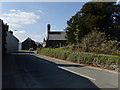
Llanuwchllyn Church
The parish church of St Deiniol is a Grade II* listed building.
Image: © Eirian Evans
Taken: 23 May 2018
0.01 miles
2
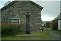
Llanuwchllyn village pump
Llanuwchllyn village pump sits just off Church Street.
Image: © Bob Walters
Taken: 25 Nov 2007
0.02 miles
3
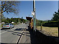
Bus stop at Llanuwchllyn
Buses between Ruabon and Dolgellau stop here, the same stop for both directions as the buses proceed down this road to turn round at its end.
Image: © Eirian Evans
Taken: 23 May 2018
0.02 miles
4
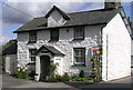
Old School House, Llanuwchllyn, Bala
Commemorated to Wyn Bar in 1841
Image: © Rick Crowley
Taken: 16 May 2010
0.02 miles
5

Blue water pump
The plaque reads "Cofeb y Cyhoedd am enedigaeth etifedd Wynnstay, Ionawr 25 1891" - the pump was erected by public donation on the birth of a new son to the Williams-Wynn family.
Image: © Eirian Evans
Taken: 20 Mar 2006
0.02 miles
6
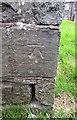
Ordnance Survey Cut Mark
This OS cut mark can be found on the SW angle of St Deiniol's Church. It marks a point 171.300m above mean sea level.
Image: © Adrian Dust
Taken: 9 May 2016
0.02 miles
7
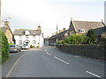
The main street of Llanuwchllyn with the old schoolhouse on the left
Image: © Eric Jones
Taken: 5 Jun 2007
0.05 miles
8
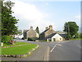
Junction of the B4403 with the A494 at the entrance to the linear village of Llanuwchllyn
Image: © Eric Jones
Taken: 5 Jun 2007
0.06 miles
9
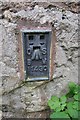
Ordnance Survey Flush Bracket (11430)
This OS Flush Bracket can be found on the cottage at the road junction. It marks a point 169.721m above mean sea level.
Image: © Adrian Dust
Taken: 9 May 2016
0.06 miles
10
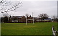
Ysgol O M Edwards, Llanuwchllyn
The School is named after Owen Morgan Edwards, who took the first steps towards ensuring that the Welsh language was taught in the schools of Wales. His son Ifan ab Owen Edwards founded Urdd Gobaith Cymru ("The Welsh League of Youth").
Image: © Eirian Evans
Taken: 20 Mar 2006
0.06 miles