IMAGES TAKEN NEAR TO
Talrych, ABERGELE, LL22 9SH
Introduction
This page details the photographs taken nearby to Talrych, LL22 9SH by members of the Geograph project.
The Geograph project started in 2005 with the aim of publishing, organising and preserving representative images for every square kilometre of Great Britain, Ireland and the Isle of Man.

There are currently over 7.5m images from over14,400 individuals and you can help contribute to the project by visiting https://www.geograph.org.uk
Image Map (Loading...)


Getting Data...Please wait
Leaflet Map data © OpenStreetMap
Images are licensed for reuse under creativecommons.org/licenses/by-sa/2.0
Notes
- Clicking on the map will re-center to the selected point.
- The higher the marker number, the further away the image location is from the centre of the postcode.
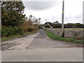
Image Listing (11 Images Found)
Images are licensed for reuse under creativecommons.org/licenses/by-sa/2.0
Image
Details
Distance
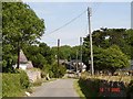
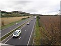
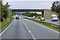
2
A55 overbridge near St George Llansan Sior
Image: © N Chadwick
Taken: 24 Jun 2012
0.08 miles
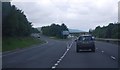
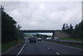
4
Bridge over the North Wales Expressway near St George
Image: © David Dixon
Taken: 24 Sep 2017
0.09 miles
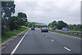
5
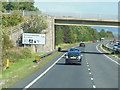
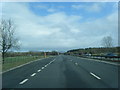
A55 North Wales Expressway
Eastbound towards Kimmel Services
Image: © Ian S
Taken: 28 Aug 2014
0.09 miles