
IMAGES TAKEN NEAR TO
St. George, ABERGELE, LL22 9RS
Introduction
This page details the photographs taken nearby to LL22 9RS by members of the Geograph project.
The Geograph project started in 2005 with the aim of publishing, organising and preserving representative images for every square kilometre of Great Britain, Ireland and the Isle of Man.

There are currently over 7.5m images from over14,400 individuals and you can help contribute to the project by visiting https://www.geograph.org.uk
Image Map
Images are licensed for reuse under creativecommons.org/licenses/by-sa/2.0
Notes
- Clicking on the map will re-center to the selected point.
- The higher the marker number, the further away the image location is from the centre of the postcode.
Image Listing (5 Images Found)
Images are licensed for reuse under creativecommons.org/licenses/by-sa/2.0
Image
Details
Distance
1
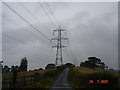
Pylon and lane
Electricity pylon and lane off the Roman road near Glascoed
Image: © Dot Potter
Taken: 24 Jul 2005
0.09 miles
2
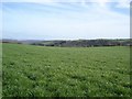
Fields between Moelfre and Glascoed
Farm fields which lead down into the valley. The Clwydian range can be glimpsed in the background
Image: © Dot Potter
Taken: 23 Apr 2006
0.09 miles
3
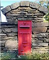
Victorian Postbox in lane
In use as the house's postbox nowadays. Inscribed as VR.
Possibly a Chinese facia plate, as the 2 crowns show it's not genuine.
Image: © Joseph Jones
Taken: 21 Oct 2023
0.12 miles
4
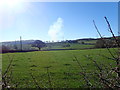
Farm land, between St Asaph and Betws yn Rhos
The smoke on the horizon is from a mountainside fire near Llannefydd
Image: © Eirian Evans
Taken: 26 Feb 2019
0.24 miles
5

Tree on a field boundary, east of Sarn Rug
Almost hiding the distant Nant Meifod farm.
Image: © Christine Johnstone
Taken: 28 Apr 2017
0.24 miles