IMAGES TAKEN NEAR TO
Llanfairtalhaiarn, ABERGELE, LL22 8YY
Introduction
This page details the photographs taken nearby to LL22 8YY by members of the Geograph project.
The Geograph project started in 2005 with the aim of publishing, organising and preserving representative images for every square kilometre of Great Britain, Ireland and the Isle of Man.

There are currently over 7.5m images from over14,400 individuals and you can help contribute to the project by visiting https://www.geograph.org.uk
Image Map (7 Images)
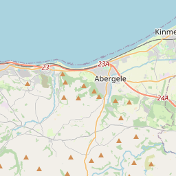
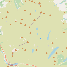
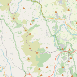

Leaflet Map data © OpenStreetMap
Images are licensed for reuse under creativecommons.org/licenses/by-sa/2.0
Notes
- Clicking on the map will re-center to the selected point.
- The higher the marker number, the further away the image location is from the centre of the postcode.
Image Listing (7 Images Found)
Images are licensed for reuse under creativecommons.org/licenses/by-sa/2.0
Image
Details
Distance
1
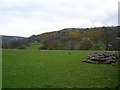
Hillside gorse
Oh the hills above Llanfair TH leading up to Mynydd Bodran. The yellow gorse is prolific at this time of year in the hills and fields in the area.
Image: © Dot Potter
Taken: 30 Apr 2006
0.13 miles
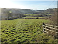
2
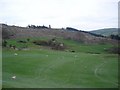
Fields above Llanfair TH
The fields lead up from the village on steep hills. The majority of this farmland is used for sheep grazing.
Image: © Dot Potter
Taken: 30 Apr 2006
0.13 miles
3
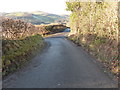
Road junction above Llanfair Talhaiarn
Image: © David Medcalf
Taken: 30 Dec 2014
0.14 miles
4
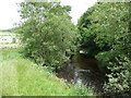
Footbridge over the Elwy
The chocolate coloured waters runs slowly under the iron footbridge.
Image: © Jeremy Bolwell
Taken: 22 Jun 2011
0.16 miles
6
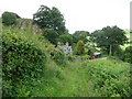
Footpath above the Elwy Valley
The lane gives way to grassy pathway here below Tan y Bodran.
Image: © Jeremy Bolwell
Taken: 22 Jun 2011
0.20 miles
7
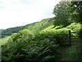
Footpath above the Elwy Valley below Mynydd Bodran
A really lovely valley side walk across the boundary between the bracken clad slopes of the hill and the fields of the valley.
Image: © Jeremy Bolwell
Taken: 22 Jun 2011
0.25 miles