
IMAGES TAKEN NEAR TO
Rhydyfoel Road, ABERGELE, LL22 8EG
Introduction
This page details the photographs taken nearby to Rhydyfoel Road, LL22 8EG by members of the Geograph project.
The Geograph project started in 2005 with the aim of publishing, organising and preserving representative images for every square kilometre of Great Britain, Ireland and the Isle of Man.

There are currently over 7.5m images from over14,400 individuals and you can help contribute to the project by visiting https://www.geograph.org.uk
Image Map
Images are licensed for reuse under creativecommons.org/licenses/by-sa/2.0
Notes
- Clicking on the map will re-center to the selected point.
- The higher the marker number, the further away the image location is from the centre of the postcode.
Image Listing (11 Images Found)
Images are licensed for reuse under creativecommons.org/licenses/by-sa/2.0
Image
Details
Distance
2
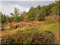
Cotoneaster a phinwydd / Cotoneaster and pines
Image: © Ceri Thomas
Taken: 27 Nov 2011
0.12 miles
3
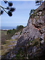
Limestone quarry
The mass of the coastal hills are broken by the Afon Dulas, forming steep valley sides. The carboniferous limestone was a valuable resource and has been quarried extensively on this outcrop.
Image: © Jonathan Wilkins
Taken: 14 Mar 2008
0.12 miles
4
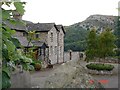
Bryn Dulas
Bryn Dulas (Dulas Hill) seen through a farmyard on the road between Rhyd y Foel and Llanddulas
Image: © Dot Potter
Taken: 23 Jul 2005
0.13 miles
5
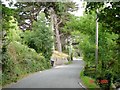
Country lane at Rhyd y Foel
Lane from Rhyd y Foel leading down towards the coast
Image: © Dot Potter
Taken: 23 Jul 2005
0.13 miles
6
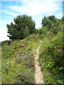
Footpath
The vegetation is encroaching upon the open hillside above the woodland fringing the road to Rhyd-y-Foel. Self-seeded pine and cotoneaster are prominent.
Image: © Jonathan Wilkins
Taken: 11 Jun 2008
0.16 miles
7
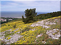
Limestone outcrop
The short turf overlying the outcrop of Carboniferous Limestone comprises a high proportion of Common Rockrose (Helianthemum nummularis), giving an astonishing yellow carpet in this view.
Image: © Jonathan Wilkins
Taken: 11 Jun 2008
0.18 miles
8
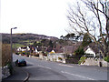
Ffordd Newydd
A rather surprisingly suburban road on the edge of the village of Llanddulas, branching off the road to Rhyd-y-Foel.
Image: © Jonathan Wilkins
Taken: 14 Mar 2008
0.18 miles
9
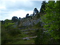
Old Quarry, Terfyn
On the very steep ascent onto Cefn yr Ogof, Ridge of the Cave.
Image: © Michael Graham
Taken: 16 May 2013
0.19 miles
10
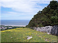
Woodland margin
The estate of Gwrych Castle Image is enclosed on all sides by a wall. The seaward side of the hill named Cefn yr Ogof is extensively planted with conifers and the edge of the forest makes a ruler-straight feature in the landscape.
Image: © Jonathan Wilkins
Taken: 11 Jun 2008
0.21 miles