
IMAGES TAKEN NEAR TO
Trofarth, ABERGELE, LL22 8BG
Introduction
This page details the photographs taken nearby to LL22 8BG by members of the Geograph project.
The Geograph project started in 2005 with the aim of publishing, organising and preserving representative images for every square kilometre of Great Britain, Ireland and the Isle of Man.

There are currently over 7.5m images from over14,400 individuals and you can help contribute to the project by visiting https://www.geograph.org.uk
Image Map
Images are licensed for reuse under creativecommons.org/licenses/by-sa/2.0
Notes
- Clicking on the map will re-center to the selected point.
- The higher the marker number, the further away the image location is from the centre of the postcode.
Image Listing (11 Images Found)
Images are licensed for reuse under creativecommons.org/licenses/by-sa/2.0
Image
Details
Distance
1
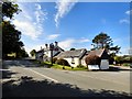
Holland Arms, Trofarth
A 17th century coaching inn on the B5113, the high road from Colwyn Bay to Pentrefoelas.
Image
Image: © Gerald England
Taken: 16 Sep 2015
0.01 miles
2
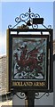
Sign of the Holland Arms
Sign for the Holland Arms Image
Image: © Gerald England
Taken: 16 Sep 2015
0.01 miles
3
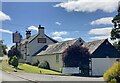
The Holland Arms
On the old road from Colwyn Bay to Llanrwst.
Image: © Alan Hughes
Taken: 22 Jun 2024
0.01 miles
4
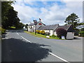
Holland Arms public house
On the B5113 road from Colwyn Bay area to Llanrwst. Long time no visit - must try out their current menu deals.
Image: © Richard Hoare
Taken: 28 Jul 2012
0.04 miles
5
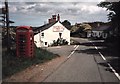
Holland Arms, Near Eglwysbach, Colwyn Bay.
A view looking towards Holland Arms.
Image: © Stephen Elwyn RODDICK
Taken: Unknown
0.05 miles
6
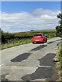
Red car
Travelling northwards on the A5113.
Image: © Alan Hughes
Taken: 22 Jun 2024
0.06 miles
7
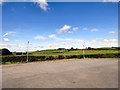
Cefn Du
View towards the mast at Cefn Du from the car park of the Holland Arms.
Image: © Gerald England
Taken: 16 Sep 2015
0.08 miles
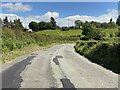
10
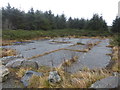
Hard base in the forest
Long disused, it seems. Purpose? Perhaps military, probably forestry - a rough track at the far side leads nowhere.
Image: © David Medcalf
Taken: 5 Jan 2015
0.21 miles