
IMAGES TAKEN NEAR TO
Lon Kinmel, ABERGELE, LL22 7SG
Introduction
This page details the photographs taken nearby to Lon Kinmel, LL22 7SG by members of the Geograph project.
The Geograph project started in 2005 with the aim of publishing, organising and preserving representative images for every square kilometre of Great Britain, Ireland and the Isle of Man.

There are currently over 7.5m images from over14,400 individuals and you can help contribute to the project by visiting https://www.geograph.org.uk
Image Map
Images are licensed for reuse under creativecommons.org/licenses/by-sa/2.0
Notes
- Clicking on the map will re-center to the selected point.
- The higher the marker number, the further away the image location is from the centre of the postcode.
Image Listing (142 Images Found)
Images are licensed for reuse under creativecommons.org/licenses/by-sa/2.0
Image
Details
Distance
1
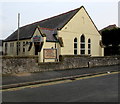
Pensarn Family Church, Abergele
Viewed across Berllan, south of Towyn Road.
Grade II listed English Presbyterian Church http://www.geograph.org.uk/photo/4898386 is nearby, out of shot on the left.
Image: © Jaggery
Taken: 27 Feb 2016
0.05 miles
2
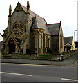
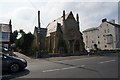
Two churches, Berllan, Pensarn, Abergele
Dominating the view is the Grade II listed English Presbyterian Church http://www.geograph.org.uk/photo/4898355 on the corner of Berllan and Towyn Road. An edge of the smaller Pensarn Family Church http://www.geograph.org.uk/photo/4898303 is behind the lamppost on the right.
Image: © Jaggery
Taken: 27 Feb 2016
0.05 miles
3
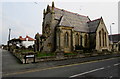
Grade II listed English Presbyterian Church, Pensarn, Abergele
Built on the corner of Berllan and Towyn Road in 1877-1878 to serve the growing English-speaking community in this area. The building was Grade II listed in 1997.
Image: © Jaggery
Taken: 27 Feb 2016
0.06 miles
4
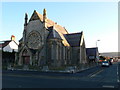
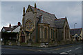
Pensarn Family Church
On Towyn Road, Pensarn.
Image: © Eirian Evans
Taken: 6 Dec 2008
0.06 miles
6
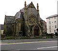
North side of English Presbyterian Church, Pensarn, Abergele
Viewed across Towyn Road. Built in 1877-1878 to serve the growing English-speaking community in this area. The building was Grade II listed in 1997.
Image: © Jaggery
Taken: 27 Feb 2016
0.06 miles
7
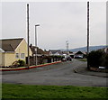
Cilfan, Pensarn, Abergele
Cilfan is a cul-de-sac set back from the south side of the A548 Towyn Road.
Image: © Jaggery
Taken: 27 Feb 2016
0.07 miles
9
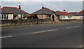
Marine Road bungalows, Pensarn, Abergele
On the north side of the A548 Marine Road. Originally, bungalow was used in English for a lightly-built house, with a veranda and one storey. In current UK usage it is a convenient word for any one-storey dwelling.
Image: © Jaggery
Taken: 27 Feb 2016
0.08 miles
10
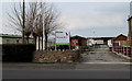
Kingsley Holiday Park entrance, Pensarn, Abergele
From the A548 Marine Road.
Image: © Jaggery
Taken: 27 Feb 2016
0.08 miles