
IMAGES TAKEN NEAR TO
Lon Gadlas, ABERGELE, LL22 7ET
Introduction
This page details the photographs taken nearby to Lon Gadlas, LL22 7ET by members of the Geograph project.
The Geograph project started in 2005 with the aim of publishing, organising and preserving representative images for every square kilometre of Great Britain, Ireland and the Isle of Man.

There are currently over 7.5m images from over14,400 individuals and you can help contribute to the project by visiting https://www.geograph.org.uk
Image Map
Images are licensed for reuse under creativecommons.org/licenses/by-sa/2.0
Notes
- Clicking on the map will re-center to the selected point.
- The higher the marker number, the further away the image location is from the centre of the postcode.
Image Listing (81 Images Found)
Images are licensed for reuse under creativecommons.org/licenses/by-sa/2.0
Image
Details
Distance
1
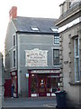
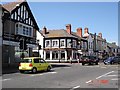
The view up Church Street, Abergele
No.51 Market Street, formerly Medical Hall - a grade II listed building.
Image: © Eirian Evans
Taken: 6 Dec 2008
0.06 miles
2
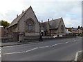
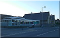
Abergele Youth and Community Centre
Based in a former school.
Image: © Richard Hoare
Taken: 8 Nov 2012
0.10 miles
3
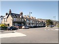
Abergele, New York Terrace
Walking from the centre of Abergele, New York Terrace is located on the left hand side of Market Street, opposite Tesco.
Image: © David Dixon
Taken: 21 Apr 2015
0.11 miles
4
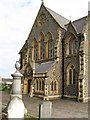
Capel Mynydd Seion
The dramatic, Gothic entrance to the Calvinist Methodist chapel is executed in brick and Penmaenmawr 'granite'. The design by Richard Owen of Liverpool incorporates a narthex, transepts, apse and gallery. Not an easy building to photograph due to its elevated position and encroaching trees and burial ground.
Image: © Jonathan Wilkins
Taken: 7 Aug 2008
0.11 miles
6
Abergele Library
On Market Street, Abergele
Image: © Eirian Evans
Taken: 6 Dec 2008
0.11 miles
8
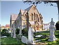
Abergele, Eglwys Mynydd Seion
The Calvinistic Methodist chapel was rebuilt in 1867-8 in early Gothic style to replace the earlier smaller chapel of 1791 close to the same site. The present building is set on an elevated platform, almost opposite the junction with High Street. This chapel now serves the Welsh Presbyterian community.
The church is built of rock-faced black basaltic stone, probably from Penmaenmawr, with sharply contrasting Batholithic limestone dressings, and a slate roof.
The main south front has a gabled central section with 3 close-set Gothic 2-light windows, a roundel in the apex, and lean-to narthex-porch, gabled over the central moulded door case, which is angled at the head.
The church is grade II-listed (Cadw Building ID: 18662 http://www.britishlistedbuildings.co.uk/wa-18662-eglwys-mynydd-seion-abergele#.VTqvqmd0x_s British Listed Buildings) as “a distinctive and well-preserved chapel by a notable chapel architect”.
Image: © David Dixon
Taken: 21 Apr 2015
0.12 miles
9
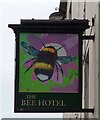
Sign of The Bee Hotel
Sign for The Bee Hotel Image
Image: © Gerald England
Taken: 27 Jun 2021
0.12 miles
10
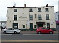
Bee Hotel
The Bee Hotel was one of the largest coaching inns in the area. In 1840 a guidebook said it and the Union Hotel were "superior inns affording unusual comforts". In 1801 the proprietor, John Davies, advertised that he had started hiring coaches (chaises) and horses to travellers at rates which undercut his rivals between Holywell and the Bangor ferry (where passengers for Holyhead would cross the Menai Strait). His advert – a copy of which is on display inside the Bee Hotel – reminded travellers that his rivals demanded gentlemen pay the full fare between St Asaph and Conwy before setting out from either of those towns. Once they had paid, the travellers couldn't break the journey at Abergele to take on fresh horses, he claimed. "When the distance between St Asaph and Conway is considered, it is presumed a change of horses nearly midway, will greatly contribute to the ease and expedition of gentlemen travelling that road."
After the railway replaced long-distance coach travel, the Bee provided a horse-drawn omnibus which shuttled between Abergele and the railway station at Pensarn. The Bee was the venue for the inquest after the 1868 train crash in Llanddulas, which killed 33 people. The extensive land associated with the Bee Hotel included a large garden on the opposite side of the road, known as Pendre Bach or the Bee Gardens. North-west of the inn was the Bee Inn farm, which covered 149 acres (600,000 square metres) according to tithe records from 1840. The property belonged to the Kinmel Estate until it was sold in an auction – held at the Bee Hotel – in 1896. History Points: https://historypoints.org/index.php?page=bee-hotel-abergele
More recently it was a J W Lees house from 1943 until 2017 when it closed down. It appears to have been bought and re-sold at least once since then and is now boarded up and in a sorry state.
Image
Image: © Gerald England
Taken: 27 Jun 2021
0.12 miles