
IMAGES TAKEN NEAR TO
Lon Ffawydd, ABERGELE, LL22 7DU
Introduction
This page details the photographs taken nearby to Lon Ffawydd, LL22 7DU by members of the Geograph project.
The Geograph project started in 2005 with the aim of publishing, organising and preserving representative images for every square kilometre of Great Britain, Ireland and the Isle of Man.

There are currently over 7.5m images from over14,400 individuals and you can help contribute to the project by visiting https://www.geograph.org.uk
Image Map
Images are licensed for reuse under creativecommons.org/licenses/by-sa/2.0
Notes
- Clicking on the map will re-center to the selected point.
- The higher the marker number, the further away the image location is from the centre of the postcode.
Image Listing (5 Images Found)
Images are licensed for reuse under creativecommons.org/licenses/by-sa/2.0
Image
Details
Distance
1
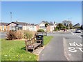
Seat by Llanfair Road, Abergele
Bus stop on Llanfair Road, outskirts of Abergele.
Image: © David Dixon
Taken: 21 Apr 2015
0.10 miles
2
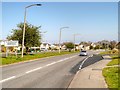
Welcome to Abergele - Historic Market Town
Sign on Llanfair Road, entering Abergele from the south.
Image: © David Dixon
Taken: 21 Apr 2015
0.13 miles
3
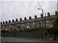
Cottages at Abergele
Row of stone cottages in the market town of Abergele
Image: © Dot Potter
Taken: 14 Jul 2005
0.23 miles
4

Bryntirion Terrace
Mae'r rhesdai ar y ffin rhwng y dref hanesyddol a'r ystadau tai diweddarach i'r de.
This terrace is at the transition between the historic town and the more recent housing estates to the south.
Image: © Ceri Thomas
Taken: 5 Jul 2008
0.24 miles
5
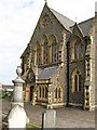
Capel Mynydd Seion
The dramatic, Gothic entrance to the Calvinist Methodist chapel is executed in brick and Penmaenmawr 'granite'. The design by Richard Owen of Liverpool incorporates a narthex, transepts, apse and gallery. Not an easy building to photograph due to its elevated position and encroaching trees and burial ground.
Image: © Jonathan Wilkins
Taken: 7 Aug 2008
0.25 miles