
IMAGES TAKEN NEAR TO
Arnon Terrace, Abbey Road, LLANGOLLEN, LL20 8SY
Introduction
This page details the photographs taken nearby to Arnon Terrace, Abbey Road, LL20 8SY by members of the Geograph project.
The Geograph project started in 2005 with the aim of publishing, organising and preserving representative images for every square kilometre of Great Britain, Ireland and the Isle of Man.

There are currently over 7.5m images from over14,400 individuals and you can help contribute to the project by visiting https://www.geograph.org.uk
Image Map
Images are licensed for reuse under creativecommons.org/licenses/by-sa/2.0
Notes
- Clicking on the map will re-center to the selected point.
- The higher the marker number, the further away the image location is from the centre of the postcode.
Image Listing (307 Images Found)
Images are licensed for reuse under creativecommons.org/licenses/by-sa/2.0
Image
Details
Distance
1
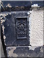
Flush bracket G3008 on Ye Old Jenny Jones Public House, Llangollen
This flush bracket is located on SW face of the (former) Ye Old Jenny Jones public house in Llangollen & it is shown in the Ordnance Survey database as being 87.1026m above the Newlyn datum.
Image: © Meirion
Taken: 11 Jul 2011
0.01 miles
2

Camellias, Abbey Road, Llangollen
A striking, well-established Camellia at 6, Abbey Road. Let's hope it is well-sheltered from late frosts and strong winds.
Image: © Martin Tester
Taken: 5 Apr 2014
0.01 miles
3
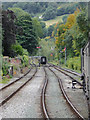
Railway north-west of Llangollen in Denbighshire
This shows the tracks on the Llangollen Railway on the approach to the town, about six hundred metres north-west of the station. The line climbing to the left leads to some sidings and a depot and railway workshops.
Image: © Roger D Kidd
Taken: 20 Sep 2015
0.02 miles
4
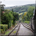
Railway north-west of Llangollen in Denbighshire
This shows the tracks on the Llangollen Railway on the approach to the town, about six hundred metres north-west of the station.
Image: © Roger D Kidd
Taken: 20 Sep 2015
0.02 miles
5
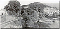
Downstream on the River Dee with the railway from Barmouth entering Llangollen, 1951
View eastward towards Llangollen station on the former GWR Barmouth - Ruabon line in the days long before its closure in 1965 and its later restoration westward from Llangollen by the present-day heritage Llangollen Railway. [The bridge I was seemingly standing on seems no longer to exist?]
Image: © Ben Brooksbank
Taken: 29 Jul 1951
0.02 miles
6
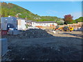
Redevelopment of the old hospital site
The closed cottage hospital has been demolished and is being replaced with a terrace of affordable houses.
Image: © John Haynes
Taken: 15 May 2016
0.03 miles
8
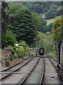
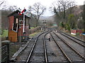
Railway lines north-west of Llangollen, Denbighshire
This shows the tracks on the Llangollen Railway on the approach to the town, about six hundred metres north-west of the station. The line climbing to the left leads to some sidings and a depot including railway workshops.
Image: © Roger D Kidd
Taken: 20 Sep 2015
0.03 miles
10
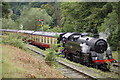
Llangollen - 2013
Llangollen, Denbighshire, Llangollen Heritage Railway (LHR), Llangollen Railway Station, GWR 7800 Manor Class Locomotive No. 7822 'Foxcote Manor'
Image: © Helmut Zozmann
Taken: 20 Aug 2013
0.03 miles