
IMAGES TAKEN NEAR TO
Trevor Square, LLANGOLLEN, LL20 8SH
Introduction
This page details the photographs taken nearby to Trevor Square, LL20 8SH by members of the Geograph project.
The Geograph project started in 2005 with the aim of publishing, organising and preserving representative images for every square kilometre of Great Britain, Ireland and the Isle of Man.

There are currently over 7.5m images from over14,400 individuals and you can help contribute to the project by visiting https://www.geograph.org.uk
Image Map
Images are licensed for reuse under creativecommons.org/licenses/by-sa/2.0
Notes
- Clicking on the map will re-center to the selected point.
- The higher the marker number, the further away the image location is from the centre of the postcode.
Image Listing (789 Images Found)
Images are licensed for reuse under creativecommons.org/licenses/by-sa/2.0
Image
Details
Distance
1
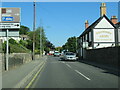
The A539 Llangollen passing the Ponsonby Arms
Image: © Roy Hughes
Taken: 10 Aug 2022
0.02 miles
2

Placing the new granite setts
The final upgrading of the canal towpath in Llangollen is underway. Here the 100mm square granite setts are being placed along the canal edge.
Image: © John Haynes
Taken: 7 Jun 2013
0.02 miles
3
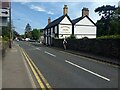
The Ponsonby Arms
Known for its fine beers.
Image: © David Medcalf
Taken: 15 May 2019
0.02 miles
4
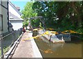
Bringing in the base layer
The final upgrading of the towpath on The Shropshire Union Canal (Llangollen Branch) as it gets into Llangollen is underway and the new under bed is being unloaded from the barge. In keeping with much of the area around the Town Moorings the path will be edged with granite setts and filled with "Granolite" surfacing as in this photograph Image]
Image: © John Haynes
Taken: 7 Jun 2013
0.03 miles

6
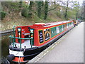
The Hermit Thrush
Narrow boat moored at Llangollen
Image: © PAUL FARMER
Taken: 6 Apr 2009
0.03 miles
7
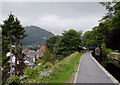
The Llangollen Canal, at Llangollen in Denbighshire
This image shows clearly how the canal is cut into the hillside above the town. Originally this was merely a feeder channel enabling water to be funnelled from the River Dee to the Ellesmere Canal near Ruabon. Navigation was not its purpose, so it is very narrow in some places.
Image: © Roger D Kidd
Taken: 19 Sep 2015
0.03 miles
8
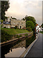
Llangollen Canal east of Wharf Hill, Llangollen, Denbighshire
Seen in fading pink-tinged evening light, looking east towards Trevor. Originally this was merely a feeder channel enabling water to be funnelled from the River Dee to the Ellesmere Canal near Ruabon. Navigation was not its purpose, so it is very narrow in some places.
Image: © Roger D Kidd
Taken: 19 Sep 2015
0.03 miles
9
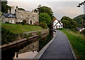
Llangollen Canal east of Wharf Hill, Llangollen, Denbighshire
Seen in fading pink-tinged evening light, looking east towards Trevor. Originally this was merely a feeder channel enabling water to be funnelled from the River Dee to the Ellesmere Canal near Ruabon. Navigation was not its purpose, so it is very narrow in some places.
Image: © Roger D Kidd
Taken: 19 Sep 2015
0.03 miles
10

Llangollen Canal east of Wharf Hill, Llangollen, Denbighshire
Looking east towards Trevor. Originally this was merely a feeder channel enabling water to be funnelled from the River Dee to the Ellesmere Canal near Ruabon. Navigation was not its primary purpose, so it is very narrow in some places.
Image: © Roger D Kidd
Taken: 20 Sep 2015
0.03 miles