
IMAGES TAKEN NEAR TO
Pengwern, LLANGOLLEN, LL20 8AU
Introduction
This page details the photographs taken nearby to Pengwern, LL20 8AU by members of the Geograph project.
The Geograph project started in 2005 with the aim of publishing, organising and preserving representative images for every square kilometre of Great Britain, Ireland and the Isle of Man.

There are currently over 7.5m images from over14,400 individuals and you can help contribute to the project by visiting https://www.geograph.org.uk
Image Map
Images are licensed for reuse under creativecommons.org/licenses/by-sa/2.0
Notes
- Clicking on the map will re-center to the selected point.
- The higher the marker number, the further away the image location is from the centre of the postcode.
Image Listing (60 Images Found)
Images are licensed for reuse under creativecommons.org/licenses/by-sa/2.0
Image
Details
Distance
1
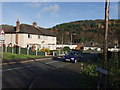
Houses at Pengwern
Mixed houses on the small estate on the edge of town.
Image: © John Haynes
Taken: 29 Nov 2007
0.05 miles
2
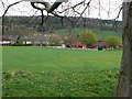
Ysgol Bryn Collen
Junior school to the south of Llangollen.
Image: © Eirian Evans
Taken: 16 Apr 2011
0.06 miles
3
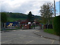
Ysgol Bryn Collen, Llangollen
Junior school on the outskirts of Llangollen.
Image: © Eirian Evans
Taken: 16 Apr 2011
0.07 miles
4
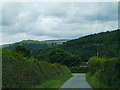
Approaching Llangollen
Bottom end of Allt Y Gwernant, Castell Dinas Bran visible
Image: © Chris Gunns
Taken: 21 Jul 2012
0.09 miles
5
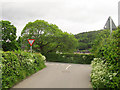
Ildiwch / Give Way
A bilingual sign at the junction of Allt y Gwernant (foreground) and Bache Mill Road.
Image: © Stephen Craven
Taken: 21 May 2017
0.09 miles
6

The way to Glyn Ceiriog
A country way to Glyn Ceiriog from Llangollen, up a 13% hill.
Image: © Eirian Evans
Taken: 16 Apr 2011
0.09 miles
7
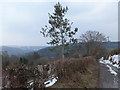
Young holly tree
This tree has been allowed to grow in a hedge that is mechanically trimmed.
Image: © John Haynes
Taken: 9 Apr 2013
0.10 miles
8
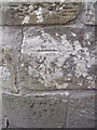
Benchmark on Pont Felin-Bache, Llangollen
This benchmark is located on the S parapet of Pont Felin-Bache on Bache Mill Road in Llangollen & it is shown in the current Ordnance Survey database at a height of 110.7095m above the Newlyn datum.
Image: © Meirion
Taken: 12 Jul 2011
0.12 miles
9
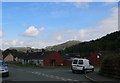
View north from Pengwern, Llangollen
View towards the Eglwyseg rocks and Dinas Bran castle.
Image: © Eirian Evans
Taken: 16 Apr 2011
0.12 miles
10
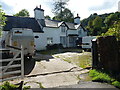
Cherrytree Farmhouse
Grade II listed https://www.britishlistedbuildings.co.uk/300001229-cherrytree-farmhouse-llangollen#.Wh0QbIZl-M8 in 1989, the farmhouse dates from the 17th century, but was extensively altered in the 19th. Amongst its interior features are an encased winding stairway, and a priest's hole.
There is a further listed barn on site here, but it lies to the left of the large van, and was more or less impossible to photograph on the day I passed.
Image: © Richard Law
Taken: 19 Sep 2017
0.13 miles