
IMAGES TAKEN NEAR TO
Berwyn Street, LLANGOLLEN, LL20 8AH
Introduction
This page details the photographs taken nearby to Berwyn Street, LL20 8AH by members of the Geograph project.
The Geograph project started in 2005 with the aim of publishing, organising and preserving representative images for every square kilometre of Great Britain, Ireland and the Isle of Man.

There are currently over 7.5m images from over14,400 individuals and you can help contribute to the project by visiting https://www.geograph.org.uk
Image Map
Images are licensed for reuse under creativecommons.org/licenses/by-sa/2.0
Notes
- Clicking on the map will re-center to the selected point.
- The higher the marker number, the further away the image location is from the centre of the postcode.
Image Listing (98 Images Found)
Images are licensed for reuse under creativecommons.org/licenses/by-sa/2.0
Image
Details
Distance
1
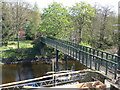
Iron footbridge to an island in the river Dee
Image: © Eirian Evans
Taken: 10 Apr 2011
0.02 miles
2
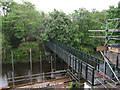
Private bridge to River Dee island
North-west of Llangollen.
Image: © Hugh Venables
Taken: 29 May 2010
0.03 miles
3
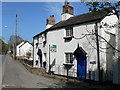
Semi-detached cottages on the A5 north of Llangollen
Squeezed in between the A5 and the river Dee, these two cottages are at an angle to each other.
Image: © Eirian Evans
Taken: 10 Apr 2011
0.04 miles
4
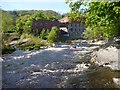
Enjoying the Dee at Mile End Mill
The Dee provides sport and entertainment at Llangollen even when smaller rivers are too low. Mile End Mill is a handy centre with paddling shop, café, changing and parking facilities (for a small charge) which gets very popular for Park'n'Play on weekends with little rainfall. Many coaches run courses here, too. The bottom wave (where the photographer was standing) can get a little too busy at times, especially when there are a lot of rafts on the river. Lunchtime can be a good time to find space and practice your surfing and freestyle moves.
Image: © Andy Waddington
Taken: 2 May 2011
0.07 miles
5
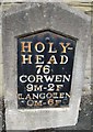
Mile Stone - Corwen 9
There is an OS cut mark on the stone. It marks a point 88.784m above mean sea level.
Image: © Adrian Dust
Taken: 30 Sep 2016
0.08 miles
6
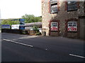
A Telford milestone (Holyhead 76) on the NE side of the A5, Llangollen
This is one of Thomas Telford's milestones located along the original London - Holyhead Road (A5). This one indicates that Holyhead is 76 miles away.
Image: © Meirion
Taken: 11 Jul 2011
0.08 miles
7
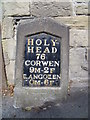
A Telford milestone (Holyhead 76), Llangollen
This is one of Thomas Telford's milestones located along the original London - Holyhead Road (A5). This one indicates that Holyhead is 76 miles away. This milestone is also inscribed with a cut mark benchmark which is recorded in the Ordnance Survey database at a height of 88.7839m above the Newlyn datum.
Image: © Meirion
Taken: 11 Jul 2011
0.08 miles
8
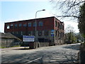
Former warehouse on the A5 north of Llangollen
Image: © Eirian Evans
Taken: 10 Apr 2011
0.08 miles
9
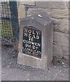
Old Milestone by the A5, Berwyn Street, Llangollen Parish
Telford Plate by the A5, in parish of Llangollen (Denbighshire District), Llangollen near 'Antique Beds', Mile End Mill.
Inscription reads:- : HOLY- / HEAD / 76 / CORWEN / 9M-2F / LLANGOLLEN / 0M-6F :
Carved bench mark below plate.
Surveyed
Milestone Society National ID: DEN_HH76
Image: © Milestone Society
Taken: Unknown
0.08 miles
10

Wild Pheasant Hotel, Berwyn Road, Llangollen
Would stay here again, a wonderful place
Image: © Josie Campbell
Taken: 22 Aug 2010
0.08 miles