
IMAGES TAKEN NEAR TO
Bethesda Street, PRESTATYN, LL19 9SJ
Introduction
This page details the photographs taken nearby to Bethesda Street, LL19 9SJ by members of the Geograph project.
The Geograph project started in 2005 with the aim of publishing, organising and preserving representative images for every square kilometre of Great Britain, Ireland and the Isle of Man.

There are currently over 7.5m images from over14,400 individuals and you can help contribute to the project by visiting https://www.geograph.org.uk
Image Map
Images are licensed for reuse under creativecommons.org/licenses/by-sa/2.0
Notes
- Clicking on the map will re-center to the selected point.
- The higher the marker number, the further away the image location is from the centre of the postcode.
Image Listing (17 Images Found)
Images are licensed for reuse under creativecommons.org/licenses/by-sa/2.0
Image
Details
Distance
1
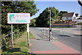
The Flintshire County Boundary at Gronant
The Denbighshire/Flintshire boundary on the A548 (Mostyn Road) at Gronant.
Image: © Jeff Buck
Taken: 7 Sep 2015
0.04 miles
2
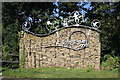
Presthaven Sands Sign at Gronant
Some kind of welcome sign or sculpture for Presthaven Sands at Lower Gronant.
Image: © Jeff Buck
Taken: 7 Sep 2015
0.04 miles
3

Huws Gray Warehouse
Huws Gray is a builders merchants chain based in Llangefni, Anglesey. Huws Gray has 60 branches located across north and mid Wales, north west of England, the Midlands and Yorkshire.
Image: © Eirian Evans
Taken: 13 Feb 2012
0.05 miles
4
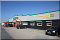
Huws Gray at Gronant
Huws Gray, builders and timber merchants in Shore Road, Gronant.
Image: © Jeff Buck
Taken: 7 Sep 2015
0.06 miles
5
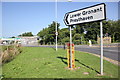
Junction at Lower Gronant
The junction of Shore Road and the A548 (Mostyn Road) at Lower Gronant.
Image: © Jeff Buck
Taken: 7 Sep 2015
0.06 miles
6
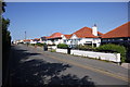
Shore Road, Gronant
Shore Road at Gronant looking north as it heads towards Presthaven Sands.
Image: © Jeff Buck
Taken: 7 Sep 2015
0.10 miles
7
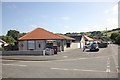
Post Office and Junction at Gronant
Gronant Post Office at the corner of Moel View Road and Shore Road.
Image: © Jeff Buck
Taken: 7 Sep 2015
0.12 miles
8
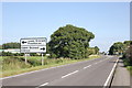
The A548 (Prestatyn Road) approaching Gronant
The A548 (Prestatyn Road) heading east on the approach to Gronant.
Image: © Jeff Buck
Taken: 7 Sep 2015
0.16 miles
9
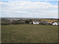
Contrast between permanent dwellings and massed caravans
From a footpath at the western end of Gronant. There are thousands of holiday caravans along the north Wales coast in the area between Gronant and Talacre
Image: © Maggie Cox
Taken: 3 Apr 2013
0.16 miles
10
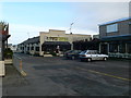
Entertainment venues Near Greenacres Holiday Park
Image: © Eirian Evans
Taken: 13 Feb 2012
0.20 miles