
IMAGES TAKEN NEAR TO
Station Road, PRESTATYN, LL19 7HF
Introduction
This page details the photographs taken nearby to Station Road, LL19 7HF by members of the Geograph project.
The Geograph project started in 2005 with the aim of publishing, organising and preserving representative images for every square kilometre of Great Britain, Ireland and the Isle of Man.

There are currently over 7.5m images from over14,400 individuals and you can help contribute to the project by visiting https://www.geograph.org.uk
Image Map
Images are licensed for reuse under creativecommons.org/licenses/by-sa/2.0
Notes
- Clicking on the map will re-center to the selected point.
- The higher the marker number, the further away the image location is from the centre of the postcode.
Image Listing (167 Images Found)
Images are licensed for reuse under creativecommons.org/licenses/by-sa/2.0
Image
Details
Distance
1

Station Road Convenience Store, Prestatyn
Premier Express store at 9 Station Road, near Prestatyn railway station.
Image: © Jaggery
Taken: 9 Feb 2017
0.01 miles
2

Karl's Fish & Chips and Karl's Cafe, Prestatyn
At 8 Station Road, near Prestatyn railway station.
Image: © Jaggery
Taken: 9 Feb 2017
0.01 miles
3

Groom Room in Prestatyn
Barber shop at 5 Station Road, near Prestatyn railway station.
Image: © Jaggery
Taken: 9 Feb 2017
0.02 miles
4
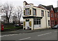
Sunlounge & Beauty Salon, Prestatyn
At 20 Marine Road, on the corner of Station Road.
Image: © Jaggery
Taken: 9 Feb 2017
0.03 miles
5

Coronation Gardens, Prestatyn
Coronation Gardens were developed in 1911 to commemorate the coronation of King George V and Queen Mary. Station Road buildings are in the background.
Image: © Jaggery
Taken: 9 Feb 2017
0.03 miles
6
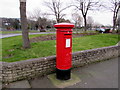
King George VI pillarbox, Marine Road, Prestatyn
On the left here. http://www.geograph.org.uk/photo/5277767 King George VI reigned from December 11th 1936 to February 6th 1952.
Image: © Jaggery
Taken: 9 Feb 2017
0.03 miles
7

Study of a Gasoline Station
BP, Prestatyn.
This photograph is part of a series taken in homage to the American artist Ed Ruscha's 1963 publication of 'Twentysix Gasoline Stations'.
More properly known as filling stations in the UK, I am attempting to photograph as many as possible to mark the sixty year anniversary.
Image: © David Bremner
Taken: 14 May 2023
0.03 miles
8

East along Marine Road, Prestatyn
This part of the A548 Marine Road is past the Territorial Army Centre.
Image: © Jaggery
Taken: 9 Feb 2017
0.03 miles
9

St John's Methodist Church Prestatyn
Viewed across Station Road.
Image: © Jaggery
Taken: 9 Feb 2017
0.04 miles
10
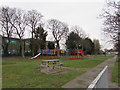
Coronation Gardens play area, Prestatyn
On the south side of the gardens. A notice at the entrance states that the equipment is suitable for ages up to 11.
Image: © Jaggery
Taken: 9 Feb 2017
0.05 miles